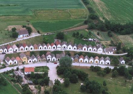
Baranya County - county of Hungary
Baranya County is in Southern Transdanubia region of Hungary. Pécs, its principal city, and Harkány, a spa town, are covered in separate articles.
Understand
The northern part of the county is a mountain area with large forests, the Mecsek Mountains. The central areas are shared between the Baranya Hills and Villány Mountains. The very eastern and southern parts are flat.
Climate
Its climate is milder than other parts of Hungary because of its southern location and relative proximity to the Mediterranean Sea in comparison to other parts of the country, leaving it with warmer winters. It has the highest average annual rainfall of the Hungarian counties and a high amount of sunshine hours.
Get in
Get around
See
- Pécs — a pleasant small university city founded by the Romans 2000 years ago.
- Harkány 📍 — content=Small spa town on the Croatian border, famous for its waters rich in sulfur. Medical waters. One of the most famous city spas.
- Abaliget (Abaligeti cseppkőbarlang), 46.1403°, 18.1166°. Stalactite cave
- Mohács (Croatian and Bunjevac: Mohač, German:Mohatsch, Serbian: Мохач, Turkish: Mohaç), 45.9959°, 18.6798°. Votive Roman Catholic Church (Fogadalmi Emléktemplom), Inner City Parish Roman Catholic Church (Belváros plébániatemplom), Franciscan Roman Catholic Church ( Ferences templom), Bishop's Roman Catholic Church (Püspök templom), Reformed Church (Református templom), The Evangelical Church (Evangélikus templom), Serbian Orthodox Church (Szerb-ortodox templom), Church of St. Roch (Szent Rókus kápolna). Buso Courtyard (Busóudvar), Kanizsai Dorottya Ceramic Museum (Kanizsai Dorottya Múzeum, kiállítás és látványtár), The Saint Nicholas Watermill Industrial History Exhibition (Malomtörténeti kiállítás a Vízimalomban), found in 1331. Busomuseum (Busóház), City Hall (Városháza), Franciscan Priory Church of St. Stephen and Monastery (Ferencesek Szent István Zárdatemploma és Kolostora), Karoly Kisfaludy High School - former Bishop's Palace ( Kisfaludy Károly Gimnázium - Püspöki Palota), Memorial battlefield or Calvary Chapel (Kálvária vagy Csatatéri Emlékkápolna), Greek Orthodox Serbian cemetery chapel (Görögkeleti szerb temetőkápolna). Every spring, the town hosts the annual Busójárás carnival.
- Máriagyűd (Croatian Đud (Szalánta), Jud (Hercegszántó), German Marju), 45.873°, 18.275°. There is famous Marian shrine and place of pilgrimage. Events: The Shrine farewell date is July 2. Other farewells: at Pentecost - Roma pilgrimage; Trinity Sunday; Visitation of Our Lady - youth farewell, Assumption - the main farewell, Virgin Mary - the main German farewell.
- Pécsvárad (German: Fünfkirchenwardein or Petschwar, Croatian: Pečvar), 46.158°, 18.422°. Sghts: Benedictine Monastery (Bencés Kolostor), Assumption Catholic Church (Nagyboldogasszony katolikus templom), and the Castle (vár), vineyards and chestnut woods (szőlők és szelídgesztenye-erdő), Neo-Gothic Town Hall (neogótikus Városházát on Szentháromság Square) was built in 1857. - More notable buildings: former military hospital (volt katonai kórház), and cavalry barracks (lovassági laktanya), the Old pharmacy (gyógyszertár), Kossuth Square buildings (Chapel, Catholic, Protestant parsonage, old school). - Events: August 15-20. „Szent István Napok” (St. Stephen's Days) musical events, exhibitions and organ concerts in the castle in the Roman Catholic church. - Every August held „Várszínház” (Castletheater). The "Leányvásár" in every even-numbered year on October 18th. Programs: traditional folk Bands festival, dance gala, folk art fair in the city center. Every odd year as „Gesztenyeszüret a Zengő alján” (Chestnut Harvest at the bottom of Zengo) events will be held
- Ormánság landscape, 45.876°, 17.842°. The churches with unique painted cassette (Drávaiványi, Adorjás, abnormal, Kovácshida) showing the elements of the ancient Hungarian symbolism system. It also has a unique folklore style. Sellye sights: Draskovich Castle (Baroque, 18th century); Arboretum (1760s); Catholic church and parish; Reformed church and rectory; Ormánság Ethnography Museum (folk block house); Thermal Bath of Sellye; Turul Statue.
- Siklós (Serbian and Croatian: Šikloš/Шиклош), 45.852°, 18.298°. Highlights: Siklos Castle (13-16th century), including museums, torture chamber; Gothic Franciscan monastery (15th century), including ceramic creative house; Malkocs Bey Mosque built in the 16th century. For relaxation, there is the Thermal Spa Siklós. Taste the local products of this excellent wine region.
- Szársomlyó Nature Reserves (Szársomlyói természetvédelmi terület), 45.856°, 18.411°.

- Szigetvár (Hungarian pronunciation: [ˈsiɡɛtvaːr]; Croatian: Siget; Turkish: Zigetvar), 46.0482°, 17.8125°. The main sigts is the Castle (Museum) founded in Celtic times (Ft 800; daily 10:00-20:00, 2011). Some monuments could be see in the town from Turkish times (16-18th century). Ali Pasha Mosque now St. Roch's Church, on the Zrinyi Square (1588, 1788). St. Anthony of Padua Franciscan Church (1736). Turkish House (Hungarian: 'Várospince' means town basement), originally caravanserai, Bástya Street (Tu-Sa 10:00-16:00). Salt House (Sóház), also known as the White House or Stagecoach station, built in 1790s. Turbéki church, in the outskirt 3 km away, in site where today's church stay, is buried Sultan Suleiman the hearts and internal organs, and above it a gilded domed octagonal tomb built, this is one of the Muslim pilgrimage site in Europe. On the day of Ascension this is a pilgrimage place for local Hungarian, German and Croatian Catholics.

- Villány, near Harkány, is one of the best wine regions of the country.
- Zselic hills (Zselic dombság), 46.2°, 17.85°. International Dark Sky Parkk (Zselici Csillagoségbolt-park), a part of the Protected Area of Zselic (Zselici Tájvédelmi Körzet), Szenna village open air museum (skanzen), take a tour in Ropolyi Forest, around the Bardy Creek fishpond chain.
.JPG/440px-Moh%C3%A1csi_Fogadalmi_templom_(by_Pudelek).JPG)