Barraba - town in New South Wales, Australia
Barraba (population 1,410 in 2016) is a village in the New England region in New South Wales, Australia.
Understand
.jpg/440px-Barraba_Victoria_Main_Street-1+_(2153386321).jpg)
Barraba is a historical village in the Nandewar Ranges. The district was explored in 1827 by Allan Cunningham, and the first farm in the district was established by 1838. The discovery of gold helped the village to grow from the 1850s. A railway ran to Barraba from 1908 to 1987. Barraba was a sheep and wheat district, but now beef cattle predominates. Copper and asbestos were mined in the district, and gemstones and fossils can be found. Barraba is in the Bundarra-Barraba Important Bird Area, which protects the habitat of the endangered regent honeyeater.
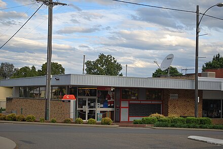
Visitor information centre
- Tamworth Regional Council - Barraba Office, 108 Queen Street (next to Barraba Cafe), -30.37894°, 150.61067°, +61 2 6782 1105, info@destinationtamworth.com.au. M-F 8:30AM-noon, 1-4:30PM, closed on public holidays. Tourist and visitor information. Centrelink agent. Service NSW office. Public library. 2019-09-01
Visitor information outlets
- Barraba Bakery, 81 Queen Street. M-F 6:30AM-4:30PM, Sa 8AM-noon. See the Eat section below. 2019-09-01
- Saunders Fruit and Vegetable Supplies, 83 Queen Street. M-F 7:30AM-5:30PM, Sa 7:30AM-noon. See the Buy section below. 2019-09-01
Get in
Barraba is on on the B95, better known as Fossickers Way, which starts at Tamworth (at the junction of the New England Highway (A15) and the Oxley Highway (B56) and heads north through Manilla to Barraba. This highway then continues north through Bingara and Warialda (intersecting with the Gwydir Highway (B76).
The Gwydir Highway (B76) heads west to Moree (and the Newell Highway (A39) and the Carnarvon Highway), Collarenebri, Walgett (and the Castlereagh Highway (B55) and Kamilaroi Highway(B76)), Brewarrina, and Bourke (and the Kidman Way (B87) and the Mitchell Highway (B71_).
The Gwydir Highway (B76) heads east to Inverell, Glen Innes (and the New England Highway (A15)), and Grafton (and the Summerland Way (B91), and to the Pacific Highway/A1 via Big River Way).
The B95 ends at the Bruxner Highway/B60 junction near Yetman. The Bruxner Highway/B60 heads northwest towards Boggabilla (and the Newell Highway/A39) and Goondiwindi (in Queensland) (and the Cunningham Highway and the Barwon Highway).
The Bruxner Highway/B60 heads east towards the Texas (in Queensland) turn-off (and to the back roads to Stanthorpe and Inglewood), Tenterfield (and the New England Highway/A15, Casino (and the Summerland Way/B91), Lismore (and the Bangalow Road/B62), and the intersection with the Pacific Highway/A1 near Ballina.
By car
The Fossickers Way/B95 is sealed along its entire length. Roads to most other places are usually unsealed part or most of the way, although they should be driveable for 2-wheel-drive vehicles under normal driving conditions.
Driver rest areas
From south to north:
- Lions Park, B95, 5 km south of Barraba (right hand side, opposite Longarm Road intersection), -30.420313°, 150.615977°. Access for light and heavy vehicles. Toilets. Picnic tables. Playground. Shelter. Litter bins. 2019-09-08
- O'Meara Park, corner of Queen and Cooper Streets (right hand side, look for steam tractor), -30.38896°, 150.60998°. Access for light vehicles. Toilets. Picnic tables. Playground. Shelter. 2019-09-08
- Australia Day Park, Queen Street (right hand side, next to Barraba Swimming Pool), -30.37537°, 150.61172°. Access for light vehicles. Picnic tables. Shelter. Nearest toilets 180 m south in Rotary Park, behind RSL Memorial hall, corner Queen and Savoy Streets. 2019-09-08
- Barraba Recreation Ground, B95 (right hand side, northern outskirts of Barraba - 100 m over Manilla River Bridge: opposite Lillis Lane), -30.3707°, 150.6077°. Access for light and heavy vehicles. Toilets. Picnic tables. Shelter. Litter bins. 2019-09-08
- Anderson Creek, B95 (left hand side, 32 km north of Barraba, past Cobbadah), -30.110762°, 150.598016°. Access for light and heavy vehicles. Picnic tables. Shelter. Litter bins. 2019-09-08
By coach
 A | NSW Trainlink (dead link: January 2023) coach service runs between Inverell and Tamworth to catch the long-distance trains at Tamworth. This coach stops in Alice Street, near the corner with Queen Street. Southbound coaches depart from here at 8:48AM W-M to Tamworth (Route 312) and northbound coaches depart 5:08PM W-M to Inverell (Route 311).
Bookings are essential - Coach drivers do not take payment or offer reservations.
Bookings
- NSW Trainlink - regular bookings, +61 13 22 32. Daily 7AM-10PM. 2019-09-10
- NSW Trainlink - multi-trip and Discovery Pass, +61 13 22 32. Daily 7AM-10PM. 2019-09-10
- Tamworth (Railway Station), Marius Street, +61 13 22 32. Daily 8:30AM-4:30 PM. 2019-09-10
- Barraba - bookings (Barraba Food & Fuel), 21 Queen Street, +61 13 22 32. 8AM - 6PM daily. The coach does not stop here - it stops 700 m north in Alice Street. 2019-09-10
- Barraba - coach stop, Alice Street (near the corner of Alice Street and Queen Street), -30.38035°, 150.60960°.
- Inverell (Windsong Travel), 45 Byron Street (between Subway and Imperial Hotel), +61 2 6722 3011. M-F 9AM-5PM, Sa 9AM-noon. The coach does not stop here - it stops at the Inverell Visitor Information Centre (Transit Centre), 11-31 Campbell Street. 2019-09-10
By plane
Barraba is not serviced by any scheduled flights, however it has an airstrip 1.6 km to the southwest. Existing effective length 3000 feet. Bearings 20 degrees 30 minutes West of North. ICAO: YBBA. Communications: CTAF: 127.1, MISC: 119.6, MISC: 122.1
- Airstrip administration, +61 2 6782 1362. 2019-10-13
The nearest airport with scheduled services is at Tamworth (IATA: TMW).
Get around
Private transport is essential, as there is neither a taxi service nor a local bus service. The nearest rental car agencies are in Tamworth, Gunnedah, and Narrabri and have low to high range vehicles. However, you could walk within the town centre.
See
In and near Barraba town
- Adams Lookout, -30.361748°, 150.6261966°. Views overlooking Barraba and Barraba Station. 2019-09-01
- Barraba Silo Art, -30.399499°, 150.614303°. On old wheat silos, depicts a water-diviner, look for the Regent Honeyeater. 2019-09-01
- Nandewar Historical Society Museum, 71 Queen Street, -30.38077°, 150.60990°, +61 2 6782 1212. Open by request. Adults $2, children 50c 2019-09-01
- Shed of Knowledge, 53 Henry Street, -30.3838°, 150.6031°, +61 2 6782 1519. By appointment only. Memorabilia collection. 2019-09-01
Northeast
- Copeton Dam, Copeton (116 km northeast of Barraba via B95, Bingara, Copeton Dam Road), -29.9047558°, 150.9207383°. Camping, childrens playground, picnic areas, toilets, fishing, kiosk, showers, boat ramps, water sports, bushwalking, golf. 2019-11-02
- Myall Creek Massacre Memorial Site, -29.781342°, 150.712709°. Location of massacre of local Wirrayaraay people - first time white settlers were punished for murdering Aboriginals, 1838. 2019-09-01
- Three Creeks Gold Mine, -30.046548°, 150.637703°, +61 2 6783 2224, threecreeksgoldmine@skymesh.com.au. M-F 9AM-5PM. Offers bushwalks, crystal fossicking, a bush camp site, barbecue facilities and a gift shop. There is also panning and a small museum of mining-related artefacts. Cash only 2019-09-01
Northwest

-
Mount Kaputar National Park (Barraba Track), -30.145052°, 150.231698°. See National Parks website for other entry locations and conditions. Permit required to access Barraba Track: $10 fee + $40 refundable deposit, paid in advance. Access to summit by 4x4, mountain bike or on foot 2019-09-01
-
Horton Falls National Park, -30.332439°, 150.337949°. Waterfall may not be flowing during prolonged dry weather. 2019-09-01
-
Sawn Rocks (Mount Kaputar National Park), -30.145052°, 150.053434°. Natural rock formation. 2019-09-01
-
Waa Gorge (Mount Kaputar National Park), Allambie Road, Berrigal (87 km northwest of Barraba via B95, Horton Road, Killarney Gap Road, Allambie Road), -30.0609836°, 150.0913318°. Picnic area with carpark, picnic tables, toilets. Waa Gorge walking track unformed, steep, many steps, Grade 5 - for experienced bushwalkers only (2.5 km, 2-3 hrs) 2019-11-02
-
Cunningham Memorial (Taylors Reserve), -30.3748588°, 150.5432374°. An obelisk marks where the explorer Allan Cunningham crossed the Manilla River in 1827. 2019-09-01
-
Rocky Creek Glacial Area, off Killarney Gap Road (58 km northwest of Barraba via B95 and Horton Road), -30.034711°, 150.316998°. Ancient glacial area. Toilets. Camping permitted. 2019-09-20
-
Terry Hie Hie Aboriginal Area (Terry Hie Hie Community Conservation Area Zone 2 - Aboriginal Culture), Terry Hie Hie (85 km northwest of Barraba via B95 and Horton Road), -29.786931°, 150.145351°. Once a traditional meeting area for the local Kamilaroi/Gamilaraay people, this area features 6 cultural reserves, Yana-y Warruwi walking track (3.5 km loop, hard, 2.5-3.5 hrs), picnic area with car parking, toilets, picnic tables, barbecue facilities, fire rings (bring your own firewood), drinking water (boil first or preferably bring your own). Limited to none mobile phone coverage. Barbecues not permitted during Fire Bans. No pets, no smoking, Walking trail is possbile for handicapped access but still hard. 2019-10-27
-
Bereen Mountain Lookout, -30.273050°, 150.416107°. Views over Horton River valley. 2019-11-01
-
Plumthorpe Travelling Stock Reserve, -30.339273°, 150.466200°. Picnic area with barbecue on the bank of the Manilla River. Enter through (and close) gate. Birdwatching area. May not be accessible if livestock present. 2019-11-01
South

-
Boonalla Aboriginal Area (Boonalla Community Conservation Area Zone 2 - Aboriginal Culture), Kelvin (67 km southwest of Barraba via B95, Longarm Road, Kelvin Road), -30.778516°, 150.343145°. Located on traditional Kamilaroi/Gamilaraay land. Walking trails, cycling trails, Boonalla Cave. Picnic ground on Eastern Forest Road (within the park) with car park, picnic tables, toilets, barbecue facilities. Car park and walking trail (1 hour return, moderate fitness, steep incline not recommended when wet) in the park near Boonalla Cave. No pets. No fires in the park. All water must be treated or bring your own. 2019-10-27
-
Keepit Dam, Keepit Dam Road, Keepit (84 km southwest of Barraba via B95, Manilla, Rushes Creek Road), -30.892625°, 150.501734°. Camping, childrens playground, picnic areas, toilets, fishing, kiosk, showers, boat ramps, water sports, bushwalking, BMX track 2019-11-02
-
Warrabah National Park, -30.5680703°, 150.9144097°. On the banks of the Namoi River. Carpark, barbecue facilities, picnic tables, toilets. 2019-11-02
-
Split Rock Dam, -30.574314°, 150.696516°. Camping, barbecues, picnic areas, toilets, fishing, showers, boat ramps, water sports, bushwalking 2019-09-01
Do
-
Watch spectator sports. Ask at TRC branch office, Saunders Fruit & Veg, or Barraba Bakery about upcoming home games. 2019-09-01
-
Fishing, Split Rock Dam & Glen Riddle Reserve. Licences available at Barraba Food & Fuel. Golden Perch, Silver Perch, Black Bream, Jew Fish, Eel-tailed Catfish, Murray Cod. 2019-09-01
-
Birdwatching. See Tamworth Birdwatchers website for details. Download a map of birdwatching locations here 2019-09-01
-
Fossicking (searching for precious metals). Fossicking reserves at Ironbark Creek and Woodreef Recreation Reserve approx 18 km northwest of Barraba on Woodsreef Road. Petrified wood and fossils found by the road near Mt Lindesay. 2019-11-03
Events

- Barraba Show. Held first weekend in March 2019-09-01
- Frost Over Barraba. Arts festival last weekend in June. 2019-09-01
- Barraba Artisans and Farmers Market. 9AM-noon. Held 4th Saturday of the month. 2019-09-01
- Upper Horton Rodeo & Campdraft, Upper Horton (37 km northwest of Barraba via B95 and Horton Road), -30.141691°, 150.4431262°, +61 2 6724 0066. Held New Year's Eve 2019-09-01
- Horton Valley Dog Trials, Upper Horton (37 km northwest from Barraba via B95 and Horton Road), -30.141691°, 150.4431262°. Held long weekend in June. 2019-09-01
- Westpac Helicopter Bowls Charity Day, Bridge Street. Lawn bowls competition - held first Sunday in September. 2019-09-01
- Barraba Races. Horse racing. Held fourth Sunday in September. 2019-09-01
- Barraba Festival & Fuller Gallery Annual Exhibition. Held second weekend in November. 2019-09-01
- Barraba Lions Club Christmas Tree. Held Christmas Eve. 2019-09-01
- Bundarra Lions Club Goat Races, Bundarra Showgrounds, corner Bombelli and Oliver Streets (66 km northeast of Barraba via B95, Woodsreef Road, McIntyre Road, Gulf Creek Road, Barraba Road), -30.171391°, 151.070978°. First weekend in November 2019-11-03
Sports
- Barraba Golf Club, Trevallyn Road, -30.3728°, 150.5916°, +61 2 6782 1264. Honesty box as clubhouse is not always open. 2019-09-01
- Barraba Memorial Swimming Pool, Queen St & Savoy Street, -30.37601°, 150.61168°, +61 2 6782 1038. Open mid-October to mid-April: Tu-F 2-6PM; Sa Su noon-6PM. Indoor 12.5 m hydrotherapy pool (open during winter), outdoor 33-m 6-lane pool with diving boards, shade covered infants wading pool, waterslide, kiosk offering hot and cold food and beverages, spacious grassed areas, and a barbecue. 2019-09-01
- Barraba Bowling Club, corner of Queen and Bridge Streets, -30.37374°, 150.61061°, +61 2 6782 1038, barrababowls@bigpond.com. M 3-9PM, Tu-Th 11AM-9:30PM, F 11AM-11PM, Sa 10AM-11PM, Su 11AM-9:30PM. Lawn bowls. 2019-09-01
- Barraba Town & District Tennis Club, 26 Queen Street, -30.38551°, 150.60965°. Court hire: day $5/hr, night $10/hr, keys available from Barraba Food & Fuel 2019-09-02
- Dynamic Muscle & Fitness Centre, 140 Queen Street, -30.3772°, 150.6119°, +61 4 2993 6335, dynamicmuscleandfitness@y7mail.com. Tu & W 5:30-8PM. Gym/fitness centre. Casual membership available during opening hours $13.50 2019-09-01
Buy
Self-catering
- Barraba IGA, 134 Queen Street, -30.37775°, 150.61099°, +61 2 6782 1199. M-F 8AM-6PM, Sa 8AM-12:30PM, Su 8AM-noon. Supermarket, liquor. 2019-09-01
- Caltex (Barraba Food & Fuel), Corner Queen & Rodney Streets, -30.3862°, 150.6088°, +61 2 6782 1058. Daily 5:30AM-8PM. Fuel, takeaways, milk, bread, BBQ chickens, grocery, lotteries, dry-cleaning, lottery, fishing licences, disabled toilets. 2019-09-01
- Caremore Pharmacy Barraba (Barraba Pharmacy & Newsagency), 113-115 Queen Street, -30.37916°, 150.61024°, +61 2 6782 1091. M-F 8AM-5:30PM, Sa 8AM-noon. Newspapers, magazines, stationery, souvenirs, prescriptions, medications. 2019-09-01
- Saunders Fruit and Vegetable Supplies, 83 Queen Street, -30.38015°, 150.61005°, +61 2 6782 1253. M-F 7:30AM-5:30PM, Sa 7:30AM-noon. Fresh fruit and vegtables, local honey 2019-09-01
- Barraba Beef, 89 Queen Street, -30.37973°, 150.60987°, +61 2 6782 1066. M-F 7:30AM-5:30PM, Sa 7:30AM-noon. Butcher. 2019-09-01
- Barraba Bakery, 81 Queen Street, -30.37998°, 150.61011°, +61 2 6782 1024. M-F 6:30AM-4:30PM, Sa 8AM-noon. Bakery. Pies, sausage rolls, cakes, sandwiches, wraps, salad bowls, cold drinks, tea, coffee, milkshakes. No gluten-free, no organic. 2019-10-05
- Barraba Rural Traders (Thrifty-Link Hardware), 64-66 Alice Street (on right-hand side before leaving town on Trevallyn Road), -30.3792°, 150.6018°, +61 2 6782 1007. M-F 8AM-5PM Sa 8:30AM-noon. Camping and outdoor supplies. Gas bottles and refills. 2019-11-13
Arts and crafts
- Fuller Gallery and Claypan, 74 Queen Street, -30.38081°, 150.61026°. Arts and crafts gallery; homemade soups, tea, coffee available F-Su 10AM-4PM. 2019-09-01
- Merlene's Fine Fibre Studio, 84 Queen Street, -30.37991°, 150.61052°, +61 2 6782 1838. Knitting, crocheting, weaving, felting, handspun yarns, jumper, hats, some rugs and shawls. Local and exotic fibres - wool, alpaca, cashmere, mohair and llama. Hand dyed from local forest plants and natural dyes. Phone for hours 2019-11-13
Eat

- Queen Street Cafe and Takeaway, 82a Queen Street, -30.38003°, 150.61080°, +61 2 6782 2106. Su-W 8AM-8PM, Th 8AM-8:30PM, F Sa 8AM-9PM. Cafe food 2019-09-01
- Barraba Bowling Club Chinese Restaurant, Bridge Street, -30.37377°, 150.61059°, +61 2 6782 1402. Lunch Tu-Su noon-2PM, dinner Tu-Su 5:30-9PM. Takeaways or dine-in 2019-09-01
- Shelley's Table, 121-123 Queen Street (Playhouse Hotel), -30.37880°, 150.61017°, +61 4 8819 2256. 2019-09-01
- Barraba Bakery, 81 Queen Street, -30.37991°, 150.61011°, +61 2 6782 1024. M-F 6:30AM-4:30PM, Sa 8AM-noon. Pies, sausage rolls, cakes, sandwiches, wraps, salad bowls, cold drinks, tea, coffee, milkshakes. No gluten-free, no organic. 2019-09-01
- Polkadot Coffee Room, 87 Queen Street, -30.37952°, 150.61019°, +61 2 6782 1717. W-F 8AM-5PM, Sa 9AM-2PM, Su 9AM-1PM. Tea, coffee, iced coffee, milkshakes, cold drinks. Light meals, sweets, morning and afternoon teas. Gluten-free and lactose-free needs catered for. 2019-09-01
- Poppy's Bistro - RSL, 2 Maude Street, -30.37771°, 150.61315°, +61 2 6782 2084. Open W-M for lunch and dinner 2019-09-01
- Barraba Cafe, 102 Queen Street, -30.37945°, 150.61113°, +61 2 6782 1454. Tu-Sa 8:30AM-7:30PM, Su M 8:30AM-6:30PM. Fresh salads, wraps, burgers, pizzas, fish & chips. Milkshakes, coffee, cold drinks. 2019-09-01
- Commercial Hotel, 136 Queen Street, -30.37745°, 150.61101°, +61 2 6782 1023. Counter lunch W-Su noon-2PM, dinner W-Su 6:30-9PM. 2019-09-01
Drink
- The Playhouse Hotel, 121-123 Queen Street, +61 2 6782 1109. 2019-09-01
- Commercial Hotel, 136 Queen Street, +61 2 6782 1023. 2019-09-01
- Barraba Bowling Club, Bridge Street, +61 2 6782 1325. M 3-9PM, Tu-Th 11AM-9.30PM, F 11AM-11PM, Sa 10AM-11PM, Su 11AM-9.30PM. 2019-09-01
- Barraba RSL & Recreational Club, 2 Maude Street, +61 2 6782 1403. M-W 11AM-8PM, Th F 11AM-10PM, Sa 10AM-10PM, Su 10AM-8PM. 2019-09-01
Sleep

Hotels
- The Playhouse Hotel, 121-123 Queen Street, -30.37871°, 150.61023°, +61 2 6782 1109, play@playhousehotel.com. Check-in: 2PM, check-out: 10AM. Licensed restaurant for guests. Queen room from $125 2019-09-01
- Commercial Hotel, 136 Queen Street, -30.37748°, 150.61098°, +61 2 6782 1023. Phone for rates and availability 2019-09-01
Motels
- Barraba Motel, 17 Edward Street, -30.38273°, 150.60889°, +61 2 6782 1555, barrabamotel@gmail.com. Restaurant for guests open daily 7AM-9PM. Devonshire teas and all-day breakfast available. Phone or email for rates and availability 2019-09-01
Guesthouses
- Andy's Guesthouse, 98 Queen Street, -30.37919°, 150.61071°, +61 2 6782 1916, info@andysguesthouse.com.au. Guesthouse. $120 per night 2019-09-01
- Oakhampton Homestead, Oakhampton Road, Upper Manilla (40 km south of Barraba), -30.5737285°, 150.6578738°, +61 2 6785 6573, info@oakhampton.com.au. Country retreat and farm stay. It's not taking bookings as of Feb 2020. Doubles from $190 per night including bed & breakfast, self-contained cottages $140, bunkhouse $55/person 2020-02-25
Caravan parks
- Barraba Caravan Park, 10-22 Bridge Street (opposite Barraba Bowling Club), -30.37240°, 150.61010°, +61 2 6782 1818. Pets permitted (under control). Dogs must be on a lead at all times. Pets are not permitted in on-site accommodation and barbecue area/camp kitchen under any circumstances See website for rates, phone for availability 2019-09-01
Camp sites
-
Lions Park, -30.420313°, 150.615977°. Toilets, barbecue, picnic tables. 2019-09-01
-
Ironbark Creek, -30.397241°, 150.727696°. Barbecue. Birdwatching area - enter through gate and walk upstream. Fossicking reserve. 2019-09-01
-
Woodsreef Reserve, -30.395017°, 150.73480°. No facilities. Fossicking reserve. 2019-09-01
-
Glen Riddle Reserve, -30.4500156°, 150.6920596°. Toilets, barbecue, picnic tables. Fishing permitted - fishing licence available from Barraba Food & Fuel 2019-09-01
-
Split Rock Dam, -30.574314°, 150.696516°. Boat ramp, toilets, barbecues, picnic tables. 2019-09-01
-
Little Creek Reserve, -30.312526°, 150.435541°. Picnic tables. Toilets. 2019-09-01
-
Horton Falls National Park, -30.332439°, 150.337949°. Toilets, Picnic Tables 2019-09-01
-
Mount Kaputar National Park (Barraba Track), -30.145052°, 150.231698°. Toilets, Picnic Tables. Permit + key: $10 + $40 refundable deposit 2019-09-01
-
Barraba Caravan Park, 10-22 Bridge Street (opposite Barraba Bowling Club), +61 2 6782 1818. See website for rates. Pets permitted (under control). Dogs must be on a lead at all times. Pets are not permitted in on-site accommodation and barbecue area/camp kitchen under any circumstances. 2019-09-01
Connect
- Telstra Air, corner Queen and Maude Streets (payphone outside the Australia Post LPO), -30.37860°, 150.61065°. Free wi-fi, requires Telstra Air app or log-ins. 2019-11-6
Cope
Emergency
- Police Station, 3 Maude Street, -30.37895°, 150.61224°, +61 2 6782 1003. not open 24 hours. 2019-10-27
- Barraba Multipurpose Service Hospital, 24 Edward Street, -30.3825°, 150.6059°, + 61 2 6782 2500. 2019-09-02
- Barraba Veterinary Clinic, 219 Mulwarree Road (continue along Rodney Street heading west out of town, on the left after the bend), -30.38463°, 150.59679°, +61 2 6782 1316. M-F 8:30AM-5:30PM. 2019-09-10
Fuel & mechanical
- Barraba Food & Fuel (Caltex), 21 Queen Street (corner Queen and Rodney Streets), -30.38610°, 150.60884°, +61 2 6782 1058. Daily 5:30AM-8PM. 2019-09-02
- Inland Petroleum (BP), 69 Queen Street, -30.38111°, 150.60974°, +61 2 6782 2046. M-F 6AM-8PM, Sa Su 6AM-6PM. 2019-09-02
- Phil Denyer Mechanical Repairs, 73 Queen Street, -30.38053°, 150.61005°, +61 2 6782 1107. M-F 8AM-5PM. Car repair and maintenance 2019-09-02
- Barraba Motors, 14 Alice Street, -30.38022°, 150.60925°, +61 2 6782 1123. Mechanic 2019-09-02
- North Barraba Diesel, 249 Bingara Road (B95) (near Woodsreef Road junction), -30.3599°, 150.6026°, +61 2 6782 2010, adorussell@hotmail.com. M-F 7:30AM-5:30PM. Diesel, oil, auto mechanical services, diesel mechanics, tyres, batteries, wheel alignment, logbook service, engine & gearbox repairs, air conditioning for cars, boats, and tractors. 2019-09-02
Public telephones
- Public phone, corner of Queen and Maude Streets (outside Barraba Post Office), -30.37866°, 150.61061°. 2019-09-02
- Public phone, corner of Queen and Rodney Streets (opposite Barraba Food & Fuel), -30.38634°, 150.60918°. 2019-09-02
Public toilets
- Public toilet, Queen Street (opposite Barraba Pharmacy & Newsagency, at pedestrian crossing), -30.37918°, 150.61050°. 24 hours. Disabled access. 2019-09-02
- Public toilet, Queen Street (in Rotary Park, between Landmark and RSL Memorial Hall. Also accessible around the corner in Savoy Street), -30.3765°, 150.6106°. 24 hours 2019-09-02
Banks
- Regional Australia Bank, 125 Queen Street, -30.3781°, 150.6104°. Tu Th 10AM-3PM. 2019-09-02
- National Australia Bank, 129 Queen Street, -30.3779°, 150.6104°. M-Th 9:30AM-4:30PM, F 9:30AM-5PM, closed for lunch 12:30-1:30PM. No ATM - nearest are across the street at Barraba IGA (24 hours) and the Commercial Hotel 2019-09-02
- Westpac Bank Agency - Landmark (Landmark/Harts Rural Agencies), 137 Queen Street, -30.37709°, 150.61065°, +61 2 6872 1007. M-F 8:30AM-5:30PM, Sa 8:30AM-noon. 2019-09-02
- Commonwealth Bank Agency - Australia Post (Australia Post), 120 Queen Street, -30.37862°, 150.61075°, +61 2 6782 1208. M-F 9AM-5PM. 2019-09-02
ATM
- Barraba IGA, 134 Queen Street. 24 hours. 2019-09-01
- Commercial Hotel, 136 Queen Street. 2019-09-01
- Barraba RSL & Recreational Club, 2 Maude Street. 2019-09-01
- Barraba Food & Fuel, Corner Queen & Rodney Streets. 2019-09-01
Services
- Australia Post - Licenced Post Office, 120 Queen Street, +61 2 6782 1208. M-F 9AM-5PM. 2019-09-02
Go next
- Bingara - north of Barraba: 62 km via B95 (northbound) (42 min)
- Warialda - north of Barraba: 106 km via B95 (northbound), continue through Bingara (1 hr 15 min)
- Yetman - north of Barraba: 185 km via B95 (northbound), Bingara, Warialda, Warialda Road/B95 (2 hr 3 min)
- Bundarra - northeast of Barraba: 68 km via B95 (northbound), turn right onto Woodsreef Road, pass Adams Lookout on the right, turn left onto Macintyre Road, turn right onto Gulf Creek Road, turn left onto Bundarra Road, pass the turn-off to Bonnay-Linton road on the right and continue ahead as Barraba Road, at Bundarra continue ahead around the bend to the right as Oliver Street (58 min)
- Tingha - northeast of Barraba: 104 km via B95 (northbound), turn right onto Woodsreef Road, pass Adams Lookout on the right, turn Left onto Macintyre Road, turn right onto Gulf Creek Road, turn left onto Bundarra Road, pass the turn-off to Bonnay-Linton road on the right and continue ahead as Barraba Road, at Bundarra continue ahead around the bend to the right as Oliver Street, in Bundarra turn left onto Bendemeer Street/Thunderbolts Way, turn right onto Howell Road (1 hr 24 min)
- Inverell - northeast of Barraba: 136 km via B95 (northbound), through Bingara, turn right onto Delungra Road, turn right onto Delungra Bypass Road, turn right onto Gwydir Highway (1 hr 33 min); 153 km via B95 (northbound), through Bingara, turn right onto Copeton Dam Road, pass Copeton Dam on the right, turn right onto Gwydir Highway (1hr 53 min); 114 km via B95 (northbound), turn right onto Woodsreef Road, pass Adams Lookout on the right, turn left into Macintyre Road, turn right onto Gulf Creek Road, turn left onto Bundarra Road, in Bundarra turn left onto Thunderbolts Way, pass through Gilgai (1 hr 32 min)
- Glen Innes - northeast of Barraba: 205 km via Fossickers Way/B95 (northbound), Bingara, turn right onto Delungra Road, pass the Myall Creek Memorial site on the left, continue straight ahead on the Bingara Road, turn right onto Inverell Street/Gwydir Highway at Delungra, continue through Inverell, continue on the Gwydir Highway (2 hr 31 min)
- Armidale - east of Barraba: 146 km via B95 (northbound), turn right onto Woodsreef Road, pass Adams Lookout on the right, turn left onto Macintyre Road, turn right onto Gulf Creek Road, turn left onto Bundarra Road, in Bundarra turn right onto Thunderbolts Way, turn right onto Bundarra Road, turn right onto Miller Street, turn left onto Kentucky Street/Uralla Road/B78 (1 hr 52 min)
- Manilla - south of Barraba: 47 km via B95 (southbound) (33 min)
- Tamworth - south of Barraba: 92 km via B95 (southbound) through Manilla (1hr 9 min)
- Gunnedah - southwest of Barraba: 92 km via B95 (southbound), turn right onto Longarm Road, pass the Hobden Road turn-off on the left and continue ahead as Kelvin Road, cross the Namoi River Bridge (1 hr 18 min); 117 km via B95 (southbound), in Manilla turn right into Market Street then left into River Street, pass the Manilla Showgrounds on the right and continue ahead as Rushes Creek Road, pass Keepit Dam on the right, turn right onto the Oxley Highway/B56, turn right at the roundabout onto the Kamilaroi Highway (1 hr 25 min)
- Boggabri - southwest of Barraba: 92 km via Fossickers Way/B95 (southbound), turn right into Longarm Road,pass the Hobden Road turn-off on the left and continue ahead as Kelvin Road, turn right onto Rangari Road, cross the Namoi River bridge (1 hr 13 min)
- Narrabri - west of Barraba: 129 km via Fossickers Way/B95 (northbound), turn left onto Horton Road at Cobbadah, pass through Uper Horton and cross the Horton River bridge, turn left onto the Killarney Gap Road, continue through twisty, turning, hair-pin bend section passing Sawn Rocks on the left, turn left onto the Newell Highway/A39 (1 hr 39 min)
- Moree - northwest of Barraba: 162 km via B95 (northbound), in Bingara turn left onto Cunningham Street then right onto West Street/Gwydir Terrace then turn left onto Herbert Street/Elcombe Road, continue on Elcombe Road over the Horton River bridge, turn left onto the Gwydir Highway and continue through Gravesend, pass Biniguy on the left, pass the Terry Hie Hie Road turn-off on the left, (1 hr 51 min); 145 km via Fossickers Way/B95 (northbound), turn left onto Horton Road at Cobbadah, pass through Uper Horton and cross the Horton River bridge, turn right onto Terry Hie Hie Road, turn left onto Gwydir Highway (1 hr 56 min)
Barraba
Tamworth Municipality
2nd-order administrative division
New South Wales
Primary administrative division