Bunnik - municipality in Dutch province of Utrecht
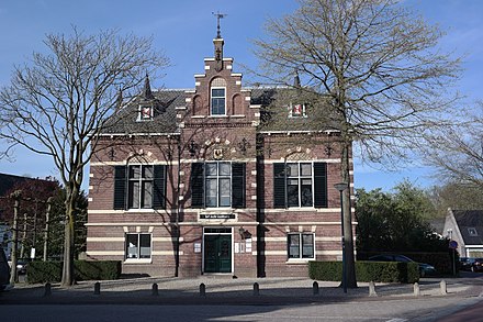 Bunnik is a town of 15,000 people (2019) in the southeast of Utrecht, the Netherlands.
Understand
The recorded history of the town dates back nearly 2,000 years, when the Romans constructed a fort at Fectio (now Vechten) with a harbour facing the river Rhine, which marked the border of the Roman Empire. The fort developed into a thriving trading centre, which continued to exist after the Romans abandoned the fort in the fourth century. Subsequently, the area was occupied by the Frisians and the Franks. In the 8th century the village of Bunninchem (Bunnik) was developed.
Chief interests of Bunnik are its surrounding nature, consisting mainly of forests, farmlands and the Kromme Rijn; and the fortresses of the Hollandic Water Line: Fort bij Vechten and Fort bij Rhijnauwen.
Get in
By car
From Utrecht or Amsterdam take the A12 towards Arnhem: Take exit 19: Bunnik. Plenty of free parking available.
By rail
Trains come from Utrecht Centraal to 📍 every half hour. This station consists of two platforms, one of which for either direction down the line. Tickets can be purchased at the ticket machine at the station. The service here runs between Utrecht and Rhenen. If you're coming from the east using an Intercity service, then change at Driebergen-Zeist, taking the sprinter one stop up the line towards Utrecht Centraal.
By bus
Take the bus 41 to Wijk bij Duurstede from Utrecht Centraal. It makes several stops in Bunnik (4-6 times every hour):
- Oud Amelisweerd: Hollandic Waterline Museum, Fort bij Vechten, Museum Oud Amelisweerd
- Rhijnauwenselaan: Youth Hostel, Fort bij Rhijnauwen, Theehuis Rhijnauwen
- Van Zijldreef : Train Station
- Centrum : Bunnik Centre
There's also a night bus, Bus 441.
Get around
Walking or using a bike is the easiest way to travel in Bunnik. Distances are short, and everything is close to wherever you are.
By bike
You can rent a bike at the unmanned OV-fiets caroussel 📍 next to the train station, which requires a OV-chipkaart. An alternative - also near the station - is the USP campus bike 📍 which you can rent using an app.
See

- Hollandic Waterline Museum, Achterdijk 12, 3981HB, 52.058611°, 5.168333°. The Waterline Museum, at Fort by Vechten, tells the story of water in its capacity as an ally in defending the Netherlands between 1588 and 1940. The museum brings the Waterline to life through personal stories, original elements and replicas, working models and digital media. €9 2018-05-27
- PopUp Museum Oud Amelisweerd, Koningslaan 9, 3981HD, 52.0674773°, 5.1694433°. W-Su 12:00 - 17:00. In an 18th-century mansion. Unique are the original 18th-century Chinese paper hangings. €5 adults; €2.50 kids 13-17 yeras old; free kids 0-12; Museumcard (Museumjaarkaart) free 2019-10-08
- Fort bij Rhijnauwen, Vossegatsedijk 5, 3981HS, 52.075°, 5.176667°. Excursions mid-April until October (minimum age 10) W 10:30 and Sa Su 13:30. Biggest fort of the Hollandic Water Line, surrounded by a mixture of forest and fields. €8.50 2018-05-27
- Oude Dorpskerk, Kerkpad 2, 3981EM, 52.06845°, 5.202894°. See service hours on website. Old village church dating back to the 13th century. free 2018-05-27
Do
- Walk along the Kromme Rijn, a small river that flows from Wijk Bij Duurstede to Utrecht.
Buy
- Kaashandel Jan van Manen, Dorpsstraat 30, 3981EB, 52.0677962°, 5.2016499°. Tu Th F 08:00-12:30 & 13:30-18:00; W 08:00-12:30; Sa 08:00-16:00. Buy Dutch (or many other) cheeses here. Especially the old Dutch cheese is recommended. 2018-05-27
Eat
- Het wapen van Bunnik, Dorpsstraat 9, 3981EA, 52.0677569°, 5.2027627°. M-Th 09:00-23:00; F 09:00-00:00; Sa 10:00-23:00; Su 10:30-23:00. French kitchen in the historic centre. 2018-05-27
- Theehuis Rhijnauwen, Rhijnauwenselaan 16, 3981HH, 52.0699266°, 5.1779456°. Daily 10:00-21:30. Nicely located pancake restaurant, with a beautiful terrace along the Kromme Rijn. 2018-05-27
- Vroeg, Achterdijk 1, 3981HA, 52.0637918°, 5.1725436°. M-F 07:00-23:00; Sa Su 08:00-23:00. This restaurant uses ingredients from the region for its dishes. It's in a monumental farmhouse from 1599, which served as a hostel until 1735. 2018-05-27
Drink
Sleep
Budget
- Hostel Stayokay Bunnik, Rhijnauwenselaan 14b, 3981 HH, 52.0691262°, 5.1776275°. In the woods on the East end of Utrecht, in an very old building in the forest of the fortress "Rhijnauwen". Easy to reach from Utrecht by car (15 minutes) or bike (25 minutes), but not recommended if you plan to go clubbing all night, in which case you’ll want to stay in the city centre. from €20
- Buitengoed de Boomgaard, Parallelweg 9, 3981 HG, 52.0596005°, 5.1982849°. Campsite in Bunnik, Utrecht.The campsite has pitches with shade, suitable for tents, caravans and motorhomes. Also it's possible to rent caravans and studios.
Midrange
- Postillion Hotel Bunnik, Baan van Fectio 1, 3981 HZ, 52.0616264°, 5.2052191°. Easy to find, close to the highway A12, standard business hotel. around €80