Eastern Marmara
Eastern Marmara
Eastern Marmara (Turkish: Doğu Marmara) is the portion of Marmara Region bounded by Istanbul to the northwest, the Western Black Sea Region to the east, Western/Central Anatolia to the south, and the Southern Marmara Region to the west. It combines urban sprawl with fascinating medieval buildings and lush forested mountains. Eastern Marmara is simply a geographical term, but roughly corresponds to the administrative provinces of Kocaeli, Sakarya and Bilecik.
Cities
- Adapazarı — one of the largest cities of the region, tried hard by the 1999 earthquake
- Gebze is an industrial large town with a well-preserved Ottoman mosque complex.
- İnegöl — Turkey's furniture capital has a well-curated city museum
- Izmit — at the end of the Gulf of İzmit, this large city is the heart of much of the Turkish heavy industry
- Iznik — historic town best known for its role in early Christianity, when it served as the site of the Councils of Nicaea
- Osmaneli — usually off the travellers' radar, this town nestled in the valley of the Sakarya River is full of white-washed Ottoman architecture
- Pazaryeri — Turkey's only hop-growing district has an unexceptional old town of somewhat over-renovated Ottoman houses in its centre, but the drive from İnegöl through mountain and forest vistas is pleasant enough
- Sapanca — pleasant lakeside town east of Izmit, surrounded by lush forests
- Söğüt — small town settled in the 13th century by yurt-dwelling Kayı tribe of the Oghuz Turks, out of whom the Ottoman Empire grew
- Taraklı — well preserved old town inside the forests, with thermal springs
- Yalova is a ferry port and beach resort, with thermal springs in its forested mountains.
- Yenişehir — agricultural town with a traditional bazaar area and an Ottoman mansion converted to a museum
Other destinations
- Kartepe 📍 means "snowy hill" and it's a ski resort east of İzmit
- Oylat is a spa resort in the hills south of İnegöl, best known for its cave.
Understand
Africa collided with Eurasia 70 million years ago and is still ploughing into it. This created mountains and volcanoes along the spine of what became Turkey - the volcanoes have ceased spewing (cross fingers) but there are continual major earthquakes along a fault line stretching the width of the country. The focus of the quakes appears to be migrating west: the latest bad one, in İzmit in 1999, was of magnitude 7.6 and took 18,000 lives. It's feared the next could devastate Istanbul.
 Eastern Marmara is therefore mountainous. The mountains draw clouds and rain, so their flanks are lushly forested. Early settlers had limited level ground for agriculture, compared to the Anatolian plateau further east, but had ample water, grazing, timber and building stone. They occupied redoubts just above the flood-prone river valleys, which every merchant traveller, pilgrim or army had to traverse. The earliest nation-state that can be identified hereabouts was Bithynia, with its capital at Nicomedia, present-day İzmit. It was independent from the 4th century BC until coming under Roman rule from 74 BC. This lasted into the 11th century within the eastern empire of Byzantium / Constantinople. Then the territory fell to a series of new dynasties, with lasting rule by the Ottomans from the 14th century. Söğüt was the initial powerbase, then Bursa further west, and later Ottoman rulers embellished these towns to underscore their own political legitimacy.
The sword-like Gulf of İzmit floods the fault line and creates a shipping route. In modern times the sea and lake coasts became leisure resorts, but drawing only domestic tourism - their attractions being a short travel time from Istanbul or Ankara, less of a frantic party scene to annoy the conservative-minded, and a fraction of the price of the raucous Aegean or Med. Other ports on the Gulf are industrial, and there's a navy base at Gölcük.
Local industries were traditionally agriculture (olives, fruit, live-stock, dairy), textiles, ceramics and timber - this finds multiple uses but especially furniture-making. In the 20th century the northwest corner became an overspill area for Istanbul, with housing and industry such as electronics and automobiles basing there to avoid city prices and congestion. There's now a continuous urban strip for 100 km east of the Bosphorus, yet even busy, relentlessly modern Gebze has at its core a 16th century religious complex. Earthquakes and invasions have smashed so many old structures across this region, with only selected palaces and mosques being rebuilt to the original plan, and Gebze's were rebuilt in 2015.
Get in
 By plane visitors from other countries arrive at one of the two Istanbul airports, IATA: IST Europe-side or IATA: SAW Asia-side. SAW has better public transport as it's connected to the Metro, while IST awaits connection in late 2023. Yenişehir Airport has flights from cities in the far east of Turkey, but as of 2022 these remain suspended because of Covid, and that airport (nominally serving Bursa) has poor onward transport.
By train YHT fast trains from Istanbul cross this region on the way to Eskişehir, Ankara and Konya. They stop at Gebze, Izmit, Arifiye (for Adapazarı), Bilecik (for Osmaneli), Bozüyük then Eskişehir. You can't use them for the short hop between Istanbul and Gebze, use the Marmaray suburban train.
By bus most towns have frequent direct buses from Istanbul, which may be on their way to Ankara. The main bus lines are Metroturizm and Flixbus (which has taken over Kamil Koç) and their booking sites are easy to navigate. Bursa and Eskişehir are secondary hubs for their nearby small towns - these local buses may not be timetabled online.
By road O-7 toll motorway heads east from Istanbul. Near Gebze is a junction: O-5 the branch south sweeps over the Gulf of Izmit towards Bursa and eventually Izmir - this is the quickest route for Iznik and İnegöl. Continue east for other cities: the road becomes E80, them E89 into Ankara.
By boat fast ferries from Istanbul sail to Yalova. A car ferry also plies between Topçular near Yalova and Eskihisar near Gebze, for those who resent the toll on the motorway bridge.
Get around
You really need your own wheels to traverse this region. The main highways are to a good standard but minor roads hairpin over the hills, with poor signage and worse oncoming drivers around the next blind bend.
Trains rush through the region but are seldom convenient for point-to-point journeys within it.
Buses radiate from the major cities, so if your destination is along such a route you're in luck. This includes routes from Ankara and Eskişehir towards Bursa and Izmir. Buses generally stop at edge-of-town stations, so you need a dolmuş or taxi to reach town centre. Local buses and dolmuşes connect smaller towns and villages but are designed for day-to-day business not tourism, and getting reliable information about departures can be your biggest headache.
See

- Külliyesi means a religious complex, centred on a mosque and also containing a medrese (seminary), imaret (hospice), hamam (baths) and other buildings. These were erected from the 13th century and refurbished in later times while secular buildings around were allowed to fall derelict. Sometimes rival patrons competed to show off their piety and charity. Many remain only as mosques, but there are more complete complexes in Gebze, Inegöl and Iznik.
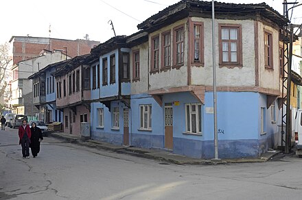
- Ottoman houses as understood by westerners generally means wooden mansions with jutting upper storeys and verandas, typical of the 19th century, and white-washed stone houses. The Ottoman tradition of course goes back much further, but older secular buildings have mostly been lost to fire, earthquake or neglect. Isolated examples are found everywhere, sometimes made over into museums, especially if Atatürk ever stayed there. More extensive neighbourhoods in that style are in Osmaneli, Bilecik, Taraklı and İzmit.
- Decorative tiles adorn many mosques and palaces. The craft was re-launched in the 17th century and is best seen in İznik, though the very finest pieces have gone far away.
- Bridges were built in early Ottoman times to carry highways across rivers that were seldom deep, but wide and dangerous in spate. There are good examples at Dilovası near Gebze, and south of Adapazarı.
- Weird attractions include Darıca Hobbit Village in Gebze and Seka Park Film Set in İzmit.
Do
_01.jpg/440px-Kartepe_kayak_Merkezi_(1)_01.jpg)
- Hiking: see Iznik#Do where several long-distance trails converge. These include Evliya Çelebi Way a 20-day route, Tolerance Way over 5 days, and Sufi Trail over 40 days. The problem is that they are poorly waymarked or maintained, and non-continuous with some sections on walker-hostile highways. Frankly they feel like tokens of good intent rather than practical trails.
- Rock climbing and canyoning: best are Ballıkayalar Valley east of Gebze and the marble Harmankaya Canyon in Bilecik Province.
- Hot springs gush out of the mountain sides, and have supported spa resorts since antiquity. There are well-developed spas at Oylat, Taraklı and Yalova.
- Winter sports: the only ski resort is on aptly-named Kartepe ("snow hill") east of İzmit. The mountain of Uludağ rises west of İnegöl but its ski area is accessed from Bursa.
- Football: there are no soccer teams in this region in Süper Lig, Turkey's top tier. Pro teams in lower tiers are based in Adapazarı, İnegöl and İzmit.
Eat

- Meat, meat, meat! This region hasn't seen any influx of foreign cuisines, so you're destined to eat a lot of trad Turkish fare such as kebabs and köfte, meatballs. Several towns have local variants, for instance İnegöl makes a big thing of its meatballs, which are lightly spiced in the Balkan style. This won't help much if meatballs comprised your last dozen meals, or if you're a vegetarian hoping for something more than another unimaginative salad.
- Fish from the sea and from the trout farms of Lake Sapanca are also popular.
- Desserts are gloochy and need to be washed down with strong Turkish coffee. For instance İzmit specialises in pişmaniye, somewhat like cotton candy.
- Lots of fruit is grown in this region, especially apples, pears, quince and cornels (cherries) in the south, and hazelnuts and kiwifruit in the north.
Drink
This region is conservative by west Turkish standards. Lots of cafes and restaurants serve beer, but there isn't a pub scene, and little wine is produced here.
Stay safe
Traffic, traffic, traffic should always be your main concern, both in town and on the country roads.
Go next
- Istanbul — heading west along the Gulf of İzmit, Istanbul's eastern suburbs are just around the corner.
- Bursa was the first city seized by the Ottomans, and is full of their heritage.
- Southern Marmara — further onwards from Bursa, the southern coast of the Sea of Marmara is lined by a series of historic towns and beach resorts.
- Istanbul to Izmir — one leg of this long-distance itinerary briefly crosses this region on its course between Turkey's two major cities.
- Western Karadeniz — in a way, this is the natural extension of Eastern Marmara, with better preserved old towns, lusher forests, steeper mountains dotted by an almost uncountable number of extremely scenic lakes.
- Central Anatolia — in the southeast where the mountains give way for the endless steppelands of the Anatolian plateau, Eskişehir is a pleasant riverside city, with a colourful old town. In the south, across the Domaniç Mountains, Kütahya is just as pleasant, with a more traditional atmosphere.