Hardap - Region of Namibia
Hardap is a region in southern Namibia.
Cities
Other destinations
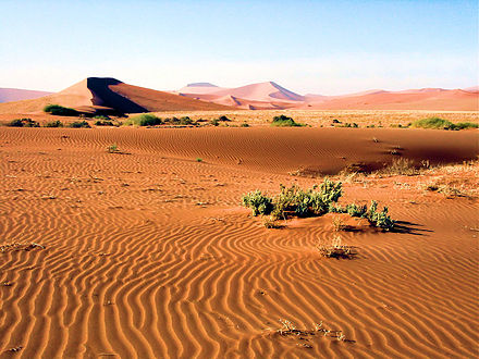
Understand
Hardap is situated on the Atlantic Ocean and borders to Botswana in the northeast and South Africa in the southeast. Within Namibia, Hardap borders the ǁKaras region in the South, Erongo in the northwest, Khomas in the north, and Omaheke in the northeast.
Get in
Due to the scarcity of other options, most travellers will arrive by car, either from abroad or on the B1, the only major road in Hardap. There are no major airports in the region but a lot of small airstrips, suitable for 2 and 4 seaters.
By train
There is a train service between Windhoek and Keetmanshoop a few times a week. The train stops at Rehoboth and Mariental, and on request at any other designated stop along the B1 which runs in parallel. As the train is predominantly for freight with only one or two passenger cars, it will stop at every tree to load and unload goods, and the journey takes a long time.
By public transport
Between towns you can catch a minibus, and Rehoboth and Mariental are on the route of the big coaches that travel to Windhoek, Cape Town and Johannesburg.
Get around
There is no public transport to tourist destinations, you have to get around by car or private airplane. You can book private tours (a 4x4 and a driver) to destinations in the Namib-Naukluft National Park in Maltahöhe.
The B1 highway is tarred and in very good condition, as are the C19 from Mariental to Maltahöhe, and the C20 from Mariental to Aranos. All other C-roads are gravel roads and in fair condition, easily passable with an ordinary sedan. Other roads (D-roads, F-roads, and those without letters or numbers) tend to be rough, rarely graded, and will require a sturdy vehicle. Expect to be able to drive 120 km/h on tar, 60-80 km/h on good gravel, and about 30 km/h on minor roads. Many of the small access roads to farms require good ground clearance and considerable driving skill. Phone the host whether you need a 4x4 or not.
Farms are private properties. Don't drive onto a farm road, even if the gate is open, unless your destination is signposted there, or you intend to visit that farm. If you open a farm gate to drive through, close it again.
See
- The Hardap Dam outside Mariental. Namibia's largest potable water dam may be used for swimming, with a permit also for fishing. Some extreme sports events like the Namibian Ironman triathlon are hosted here. Camping is not possible albeit regularly advertised, the only accommodation inside the recreation resort are Namibia Wildlife Resorts' overpriced chalets.
Do
- Hiking in the Naukluft. There are hundreds of scenic hiking trails on private farms and within the national park.
Sleep
- Aranos Hotel, 125 Nossob Street, Aranos (on C20 from Mariental.), -24.145°, 19.115°, +264 63 272 031. Check-in: 14:00, check-out: 10:00. Has a bar and a casino. N$ 500 2019-08-27
Eat
Drink
Stay safe
Go next
Hardap shares international borders with:
- South Africa in the southeast
- Botswana in the northeast Domestically, the following regions of Namibia border with Hardap:
- ǁKaras region in the south
- Erongo region in the northwest
- Khomas region in the north
- Omaheke region in the northeast
Related Wikipedia article: Hardap Region
Hardap Region
arc.org.na/home.php?pn=hardap_councilDate Time:Please wait...Timezone:Africa/WindhoekPopulation:79,000Coordinates:-24.62, 17.95