Jerusalem Hills
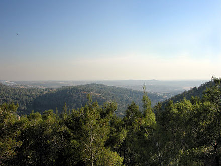
 The Jerusalem hills (Hebrew: הרי ירושלים) is a mountainous region in central Israel which includes the western part of Jerusalem.
Understand
The Jerusalem hills region is in the much broader Judean Mountains region that extends into the West Bank area - this region was captured by the Jewish fighters during the 1948 Israeli-Arab War (it was had been designated by the UN to become partly part of a future Palestinian-Arab state and partly an internationally-controlled area).
The average height of the Jerusalem Hills is about 650 m above sea level.
Talk
Hebrew. In some Arab villages you can speak Arabic. English is widely understood.
Cities and villages
- Jerusalem 📍 - Israel's capital and most populous city, which is one of the oldest cities in the world. The city contains the UNESCO World Heritage Site of the Old City. The city is sacred to Jews, Christians and Muslims.
- Mevaseret Zion 📍 - a town overlooking Highway 1 (the principal route connecting Jerusalem to Tel Aviv) which is the second largest town in the Jerusalem hills region. The Castel Mountain located in the center of the town, and the routes along it, were the focus of major battles in the 1948 Arab-Israeli War.
- Abu Ghosh 📍 - An Israeli-Arab village located on Route 1 which is mainly known for its many successful restaurants.
Get in
By car
It is easy to drive here, as the main road is Route 1, which connects Jerusalem to Tel Aviv.
By bus
The region is also served by bus routes running from Jerusalem.
- Binyanei HaUmah, 31.78788°, 35.20220°. Most bus routes to the Jerusalem Hills begin and end at this stop, adjacent to the Jerusalem Central Bus Station. 2017-12-05
By train
The existing Tel Aviv Jerusalem line while passing through stunning landscapes dates to the 19th century and is rather slow. A new line via Ben Gurion Airport is already partially open from Tel Aviv to the airport but had not reached Jerusalem as of 2017. It is planned to open a new station in Jerusalem once the line is fully built.
- Jerusalem Biblical Zoo railway station, 31.744722°, 35.176944°. One of the two train stations in Jerusalem in use as of 2017, it is close to the namesake zoo but to basically nothing else
- Jerusalem Malha railway station, 31.748083°, 35.187533°.
Get around

Highway 1 is an east-west highway the goes through the Jerusalem hills regions and is the main highway connecting Tel Aviv with Jerusalem. The road begins in Tel Aviv (at the Kibbutz Galuyot Interchange) on the west coast of Israel and ends in the east at the Jordan Valley (at the Beit HaArava Junction). It is 94 km long.
See

Historic and religious sites
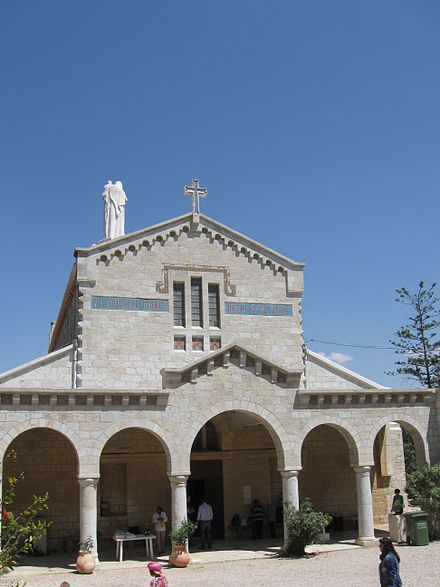
In addition to the following sites, Abu Ghosh contains some notable churches and mosques. And of course Jerusalem is one of the most important historic and religious cities in the world.
- Armored vehicles monument near Sha'ar HaGai, 31.80212°, 35.07066°. Remains of Palmach armored vehicles that were destroyed by the Jordanian Legion forces while trying to break the blockade of Jerusalem during the 1948 Arab-Israeli war. You can see the vehicles along the side of Route 1 as you drive by. You might be able to stop for a closer view by exiting Route 1 at the Shoresh interchange (just to the east of the vehicles).
- Khan Shaar HaGai, 31.81468°, 35.02396°. The historic caravanserai at the entrance to the Shaar Hagai valley. Now a museum commemorating the convoys which broke the blockade on Jerusalem.
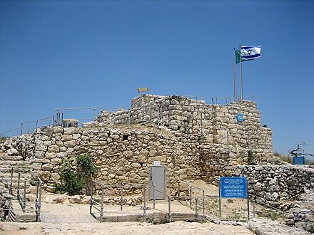
- Kastel National Park, 31.79638°, 35.14379°. Originally a Crusader fortress, by 1948 the Arab village of Al-Qastal was located here, strategically overlooking the road from Jaffa to Jerusalem. The site is mostly known for the key battles which were held there in April 1948 (Operation Nachshon) ending in Jewish capture of the village. The national park includes a memorial for the Jewish soldiers whom died in these battles (including a monument designed in 1980 by Yitzhak Yamin) and a memorial for the armored vehicles used in attempts to break through the blockade of Jerusalem.
- Motza synagogue, 31.792222°, 35.164167°. A synagogue built on the remains of an ancient building estimated to be from the Crusader period. The synagogue was built in 1871 by Joshua Yellin to be used as a motel for people traveling to Jerusalem from Jaffa. An archaeological site is adjacent to the synagogue which contains artifacts from the Second Temple period.
- Mount Tzova, 31.78496°, 35.12586°. An ancient archaeological site containing the remains of the Crusader Belmont fortress.
- The Cave of John the Baptist, 31.78430°, 35.11791°. A very large and elaborate water cistern carved in a rock. During the First Temple period water used to be stored in it as it was mainly used for agricultural purposes. After the destruction of the First Temple, and after the Jewish population returned to the region after the Babylonian exile period, the cistern was used as a Mikveh (bath used for the purpose of ritual immersion in Judaism). During the 4th century the site became a popular place of pilgrimage and worship for John the Baptist, and on the caves walls drawings were carved which relate to John the Baptist or to Christianity.
- Yad Kennedy Memorial Lookout, Mateh Yehuda (מטה יהודה), 31.749081°, 35.134717°. "And to them will I give in my house and within my walls a memorial and a name." - Isaiah 56:5. This 18-m (60-ft) Israeli memorial to John F. Kennedy on a hill overlooking Jerusalem is shaped to resemble a stump of a felled tree, representing a life cut short. 2018-09-09
Natural sights
- Soreq Cave (Avshalom Cave), 31.7559°, 35.0221°. A cave full of stalactites, stalagmites, and other impressive rock formations. It's an especially good choice in summer due to the cool underground air. You have to enter on a (free) organized tour (which often includes an entire class of school kids). You will need to wait at least 20 minutes for a tour, so be sure to arrive at least an hour before closing time. Tours are normally in Hebrew, but Arabic or English ones can be arranged. Beware that the nearest public transportation is about 5 km away, in Nes Harim or Beit Shemesh. When you turn off road 3866 to get to the cave, there is a nice picnic spot on your right, with a great view in all directions. If you're lucky, the gate to the lookout tower will be open and you can see the view from there (say hi to the fire-spotter, if he's up there). 2016-05-12
- Dinosaur footprints at Beit Zayit, 31.78207°, 35.16193°.
- Ein Hemed National Park, 31.79613°, 35.12582°. A small national park and nature reserve located about 7 km west of Jerusalem which contains natural springs and the remains of a fortified crusader farm.
- Ein Tzova, 31.78158°, 35.12938°. A natural spring which since the Second Temple period has been continuously been used to irrigate surrounding fields in addition to being used as a source of drinking water for local villages.
Do
- The Biblical Park, 31.81044°, 35.08870°. An park in the Yad HaShmona moshav which shows the lifestyle and culture of the residents living in this region during the Bible period, as well as the Talmud and Mishnah periods. The park includes orchards, fields, vineyards, and restored paths, as well as authentic archaeological findings.
- Kiftzuba, 31.78477°, 35.11513°. Amusement park.
Buy
- Harel Mall (Kanyon Harel), located in Mevasseret Zion, 31.79967°, 35.14875°, +972 2-5335416. Su-Th 9AM-9PM, F 9AM-3PM, Sa dusk-10:30PM.
Eat
.jpg/440px-Hummus_etc._(7351539600).jpg)
Abu Ghosh is famous for its food, particularly its hummus (chickpea paste). One of the restaurants in Abu Ghosh held a Guinness record for largest hummus dish, weighing 4 tons. See the Abu Ghosh article for details on restaurants there.
Breakfast menu
- Muse in the Mountain, 31.79761°, 35.06449°. Su-Th 12-10PM, F 9AM-3PM, Sa 6:30-10PM.
- Clementine, 31.80452°, 35.12734°.
- {{eat | name=Shoresh Breakfast | alt= | url=http://www.breakfastandmore.co.il (dead link: December 2020) | email= | address= | lat=31.79998 | long=35.07637 | directions= | phone= | tollfree= | fax= | hours= | price= | content= }}
- Derech HaGeffen Coffee, 31.78199°, 35.16160°.
Drink
- Link, 31.79105°, 35.14323°.
- Gordon Pub, Located in Kibbutz Ma'ale HaHamisha, 31.81939°, 35.11130°, +972 50-224-8050. open on Thursday, Friday and Saturday between 10PM until 5AM. The pub often hosts various Israeli singers and DJs.
Sleep
See Jerusalem and Abu Ghosh articles for additional listings.
- Isrotel Cramim Resort & Spa, 31.81211°, 35.12046°.
- Hotel Ma'ale HaHamisha, 31.81621°, 35.11701°.
- Yad HaShmona Country Hotel, 31.81002°, 35.08988°.
- Neve Ilan Hotel, 31.80758°, 35.07581°.
- Shoresh hotel, 31.79401°, 35.06817°.
- Tzuba hotel, 31.78385°, 35.11733°.
- Rose of Castel, 31.78898°, 35.14701°.
Stay safe
Go next
Jerusalem hills
Timezone:MultipleCoordinates:31.78, 35.07


