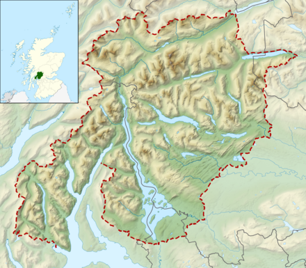
Loch Lomond and The Trossachs National Park - national park in Scotland
 Loch Lomond and The Trossachs National Park straddles the two regions of the Scottish Highlands and the Central Belt of Scotland.
Understand
Scotland's first national park is north-west of Glasgow with train access at Balloch, Arrochar/Tarbet, Ardlui and Crainlarich. It is divided into four distinct areas:

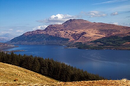
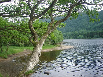
- Loch Lomond is the largest loch in Scotland, the largest body of fresh water in Britain and probably the most famous after Loch Ness. The southern end of the loch is quite flat, but the scenery soon becomes more mountainous and distinctly wild by the time you reach the north end.
- The Trossachs (dead link: January 2023), Loch Katrine and Loch Array are in the north-east
- Argyll Forest
- Breadalbane
Visitor centres
There is one national park visitor centre:
- National Park Visitor Centre Balmaha, Balmaha, G63 OJQ (in the pretty village of Balmaha, East Loch Lomond), 56.0849°, -4.5389°, +44 1389 722100. A stop-off point for walkers on the West Highland Way, local produce and top-up supplies.
Towns and villages
- Arrochar
- Callander
- Crianlarich
- Ardlui
- Inverbeg
- Balloch — located at the southern end of Loch Lomond, it is the main town on the loch, and can get busy. The Loch Lomond Shores TIC/visitors centre can help you plan your stay and provide you with close-area maps. Has a railway station.
- Luss — a town without any attractions other than its beautiful appearance and cottages, which are still worth a visit.
- Rowardennan — this village makes a great base to explore Ben Lomond.
- Drymen — good base for the Conic Hill, also a nice pub (claimed to be the oldest in Scotland) and Buchanan castle.
- Tarbet — a large village near the centre of the west shore with railway station
Islands
- Inchcailloch — the largest island in the loch
History
The Loch Lomond and the Trossachs National Park was the first national park established in Scotland. It became fully operational on 19 July 2002 and was officially opened by Princess Anne on 24 July 2002.
Landscape
The National Park encompasses around 720 sq miles (1,865 km<sup>2</sup>) of land including the Loch Lomond area and The Trossachs region.
Flora and fauna
Climate
Get in
By train
 ScotRail local trains run frequently from Glasgow's Queen Street Station low level to Balloch which is at the end of the line, taking about 50 minutes, with generally two trains per hour. The station in Balloch is easy to find.
Several trains run daily between Glasgow and Oban, Fort William and Mallaig which stop at Tarbet and Ardlui on the north-west shore and at Crainlarich in the northern part of the park. These leave from the upper level of Glasgow's Queen Street station.
The Caledonian Sleeper from London also runs up here.
Garelochhead, Arrochar/Tarbet, Ardlui, Crianlarich, Tyndrum are all on the West Highland Railway, which has around three trains per day from Glasgow Queen Street main level to Oban and Fort William.
By bus
- The A82 road up the shore of Loch Lomond is used by the Citylink buses (3 per day) from Glasgow to Fort William.
- Citylink buses from Glasgow to Campbeltown go up Loch Lomond as far as Tarbet and then pass Arrochar and Cairndow on the way to Inveraray.
- Citylink buses from Edinburgh via Stirling to Fort William pass Callander and Crianlarich. Buses run frequently between Balloch and Glasgow.
The First Western bus service towards Balloch pick up passengers at the bus stop opposite McDonald's at Jamaica Street. A full day unlimited travel ticket costs about £4.
Several buses a day between Glasgow and Campbeltown, Oban or Fort William, traveling along the western shore (A82) of the Loch. These will stop at all bus stops north of Balloch, including Luss, Inverbeg, Tarbet and Ardlui.
By car
- From Oban follow the A85, which runs parallel to the train line, and you will enter the park from its north-western boundary. On this route you also pass by Kilchurn Castle at Lake Awe.
- From Stirling follow the A84 and you will enter the park from its eastern boundary at Callander.
Fees and permits
No permit is required to enter the park or explore on foot, by bicycle or by road. Permits may be required for fishing, or some boat use.
Get around
An excellent reference tool for planning your journey is the travelinescotland website and journey planner for all bus, rail, coach, air and ferry services in Scotland. Also open 24 hours by phone on +44 871 200 22 33 .
By bus
Buses run along Loch Lomand, but not that frequently. You should check the departure-times first, as timetable are not usually available at the stops. The National Park Authority publishes a timetable of all the buses and ferries which may be available as a booklet locally.
By car
If you're driving, mind that the road along the northern part of Loch Lomond is pretty narrow for the traffic it has.
By boat
Sightseeing trips by boat on Loch Lomond run from Loch Lomond Shores near Balloch.
There is also a useful passenger ferry between Inverbeg (served by Citylink buses) and Rowardennan (at the foot of Ben Lomond mountain).
The steamship SS Sir Walter Scott offers cruises on Loch Katrine in the Trossachs. There are connecting buses from Callander and Stirling for some services.
By bike
To enjoy the nature, it is best to go by bike. There's a (relatively!) well-maintained and -signposted cycleway from Glasgow to Balloch called National Route 7. A good place to join it is Bells Bridge over the Clyde by the SECC (Scottish Exhibition and Conference Center). It's a fairly flat 20–25 miles.
See


- Queen Elizabeth Forest Park.
- Breadalbane Folklore Centre, Killin (Easily reached from Aberfeldy and Kenmore (via the A827 along the shores of Loch Tay), and from Crianlarich and Lochearnhead (via the A85 and A827)). April to October 10AM - 5PM. Overlooks The Falls of Dochart at the western end of Killin. Discover the story of Scotland's 'High Country'. Adult £2.75, Child (5-16) £1.80
- The Falls of Dochart, Killin, 56.46243°, -4.32061°.
- Glen Ogle Viaduct, 56.4082°, -4.3176°. A hiking trail starting in Lochearnhead is described on walkhighlands. 2015-10-06
- Inchmahome Priory, Lake of Menteith (along the A81), 56.17631°, -4.29813°, +44 1877 385294. Nov-Mar closed. An Augustinian monastery on an island, where Mary Stuart once hid from Henry VIII. A ferry runs to the island, but is only operated in summer. Lake of Menteith is one of the very few lakes in Scotland referred to as "lake" and not as "loch".
- Falls of Falloch, 56.35027°, -4.69111°. 2015-10-06
- Benmore Botanic Gardens, 56.0261°, -4.9813°. See Dunoon. 2015-10-07
- Kilmun Arboretum, 55.99852°, -4.94601°. 2015-10-10

- Loch Lomond Shores, Balloch, 56.0053°, -4.5920°. See Balloch.
- Balloch Castle Country Park, Balloch. See Balloch.
- Luss Village Paths, Luss (along the A82). A beautiful town with four walks around town and a sandy beach. A map can be picked up at Balloch TIC or at the Luss Visitor Information. 2015-10-07
Do
- Hiking is also a good idea. The long-distance West Highland Way also runs along the eastern shore on its way from Milngavie (near Glasgow) to Fort William.
- Hike the West Highland Way. The West Highland Way walking path journeys through some of the finest scenery that Scotland has to offer. Traveling from Glasgow (Milngavie) to Fort William, it crosses the National Park and runs the length of the eastern shore of Loch Lomond.
- Conic Hill, 56.09705°, -4.52457°. 361 m high. 2015-10-10
- Puck's Glen, 56.01333°, -4.96290°. Walk Highlands has a detailed hiking trail description for this valley. 2015-10-10
- Detailed hiking trails in this area can be found on the Walk Highlands webpage.
- Cycling is probably the best outdoor activity besides hiking.
- The Lowland Highland Trail, which is part of the National Cycle Network Route 7 starts from Balloch, going north to Drymen, Aberfoyle, Callander, Strathyre, Lochearnhead and Killin. Free leaflets with a map of the bike trail can be picked up at TICs along the trail.
- Bike the West Loch Lomond Cycle Path. This is a 16.5-mile route between Balloch and Tarbet. Bikes can be hired at the Loch Lomond Shores
- Fishing. You must have a permit or permission.
- Ben Lomond, 56.19021°, -4.63290°. A very popular climb. A majority of walkers arrive by road on the eastern side of the loch. By public transport your best option is to head to either Tarbet or Luss on the western side and then take the ferry over Loch Lomond to Rowardennan. You have to be early to catch the ferry to Rowardennan as there is only one morning service, so if you want to do Ben Lomond as a day walk this is a must. The ferry costs £11.50 return and takes approximately half an hour each way. There are two routes going up Ben Lomond. The main track which 95% of people take is from the end of the public road a few hundred metres to the south where the main carpark it located. The less taken track is in much better condition are far more peaceful and scenic. It starts a few hundred metres north of the hostel along a private road. You can go up and down the same way or make a circuit of it. From the hostel or carpark taking either route to the summit will take approximately 4.5 hours (3.5 if you're fast). Relax at the hostel grounds before taking the ferry back across. Ben Lomond is 974-m high.
- Highland Gatherings and Games are held at various villages during a summer weekend. Pipe bands, caber-tossing, field & track events and so on; often combined with Agricultural Shows. For instance Kinlochard Highland Gathering is held in mid-July (next event Fri 12 - Sun 14 July 2019); see also entries for Balloch.
Buy
Balloch is the only significant shopping centre within the park with the Lomond Shores shopping centre right on the lochside, and other shops in the town. Callander has a supermarket and several other shops. Most villages in the park have a single shop for basics and some also have specialist outlets of interest to visitors.
Eat
Drink
Sleep
As well as in the towns and villages listed above:
- There is a small pub, with outside terrace and nearby pier for boat moorings, on the island of Inchmurrin in the centre of the loch. A ferry is available from Midross, on the A82, to the island.
Camping
Unusually for Scotland, wild camping is banned in four areas: West Loch Lomond; East Loch Lomond; Trossachs West and Trossachs North. This is an extension in 2017 of the existing ban on camping at East Loch Lomond. These bylaws were introduced following excessive litter and noise in these areas. Wild camping is permitted in other areas of the park.
Budget
- Inversnaid Bunkhouse, Inversnaid, FK8 3TU, 56.2490°, -4.6689°, +44 1877 386249.
Mid-range
- Briar Cottages, Lochearnhead, FK19 8PU (M9 Stirling J10, A84 to Lochearnhead, A85), 56.3859°, -4.2743°, +44 1567 830443, briarinfo@btinternet.com. Briar cottages offer 2 holiday cottages for self catering on the banks of Loch Earn including 1 luxury cottage for 4 plus 1 pet friendly cottage for 3 guests and 2 pets in the village of Lochearnhead Perthshire. 2022-08-20
Stay safe
Go next
The following communities are located nearby:
- Doune — features Doune Castle, a 14th-century castle with a great view over the landscape, which was used to portray most of the castles in Monty Python and the Holy Grail.
- Dunoon — has the Benmore Botanic Gardens.
- Inveraray — see the Kilchurn Castle which is about 20 km north of Inveraray, at Loch Awe.
- Dumbarton — features Dumbarton Castle on top of a rock, overlooking the Firth of Clyde. It was an important royal refuge; take the A82 south.
- Helensburgh
- Milngavie