Unije - island of Croatia
 Unije is in Kvarner.
Understand
Unije Island is part of the Cres-Lošinj archipelago west of the island Lošinj. Unije is the third largest island of the archipelago, specific for its flat fertile ground near the only settlement on the island. Because of fertile ground and important location on the sea routes from Istria and Italy to Kvarner bay, the island has been inhabited since Roman times. Today, the island has only one settlement on the western bay with one shop, three restaurants and church. There is less than 100 permanent citizens, mostly older ages.
Get in
Direct catamaran from Rijeka operated by Jadrolinija and boat from Mali Lošinj (twice a day) operated by Jadrolinija are most common ways to get to mainland.
Island is also connected with Pula and Zadar by catamaran line operated by Krilo
A tiny airport is open only for private flights.
Get around
There are no cars on the island. The only way to get around is on foot. Island has well maintained walking/hiking trails with very nice views.
See
- Vnetak lighthouse, 44.6193°, 14.2355°. Old lighthouse from the 19th century is out of use, but it is still nice place to enjoy sunset and old maritime architecture. 2016-08-12
- Church of St. Andrew (Župa sv. Andrije), 44.6358°, 14.2497°. sunday mass: 18:00. Built in the 17th century, it is the dominant landmark of the village with nice white bell tower. 2016-08-12
Do

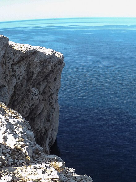
- Vele Stijene (Great cliffs), 44.6569°, 14.2391°. Big cliffs of Unije are high cliffs on western side of the island from where is wonderful view on Adriatic sea. Take a nice walk before sunset towards cliffs, around one hour walk from village. 2016-08-12
- hiking around island. Although the island has mostly low peaks (highest peak is 139 m), network of hiking paths and walking trails cross all around the island and offers numerous nice walks and hikes with beautiful view on coves on the eastern side of the island and cliffs on the western side. Nice view is also provided toward nearby islands Cres, Lošinj, Srakane and Susak. 2016-08-12
- Beach (Piesak plaža), 44.63498°, 14.24733°. Although the name of the beach is "Pijesak" (sand in Croatian language), it is actually pebble stone beach with sand inside the sea. Not so shallow as popular beach on Susak island, but very nice for families and others who enjoy easy access to sea. On other sides of the island there are plenty of rocky beaches with amazingly clear sea, also good for diving and snorkeling. 2016-08-12
Buy
Eat
- Kod Barba Ive, 44.63678°, 14.24733°. 06:00 - 23:00. Very nice restaurant with fair prices right next to ferry port with various choice of meat and fish dishes, but also very good offer of drinks and coffee. Possible payment by credit card. Very friendly staff. €10 2016-08-12