County Donegal - county in Ireland
County Donegal (Contae Dhún na nGall) is in Northwest Ireland and Lakelands Region and is the northernmost county in Ireland, stretching further north than any part of Northern Ireland. It's a large county but mostly hill and forest, with a population in 2016 of 159,192. Historically part of Ulster, Donegal was one of its three counties that joined the Republic of Ireland, while the other six are in Northern Ireland. So it's referred to as part of "the south" in spite of being so far north.
Towns and villages
- Letterkenny (Leitir Ceanainn) is the principal town of the county, with lots of amenities, and the best base for seeing the north of Donegal.
- Lifford (Leifear) is the miniscule county town, effectively part of Strabane in Northern Ireland.
- Donegal Town (Dún na nGall) is a pleasant small town with many visitor amenities.
- Ballyshannon (Béal Átha Seanaidh) on the River Erne is a market town near the beach resort of Bundoran.
- Glencolmcille (Gleann Cholm Cille) has standing stones and ritual sites associated with St Columba.
- Glenties (Na Gleannta) and Ardara are the main settlements around the Bluestack Mountains.
- Dungloe (An Clochán Liath) is the main village of The Rosses, the headlands of the west coast.
- Gweedore (Gaoth Dobhair) is the last reach of the long rugged west coast before it turns to face north.
- Falcarragh (An Fál Carrach) and Dunfanaghy are resort villages on the north coast.
- Fanad Peninsula (Fánaid) has lonely windswept headlands and a good beach at Portsalon.
- Buncrana (Bun Cranncha) is the main village on the Inishowen Peninsula, with a crumbly castle and two forts raised against Napoleon.
- Carndonagh (Carn Domhnach) is near Malin Head, the northern tip of Ireland.
Other destinations
- Glenveagh National Park 📍 is extensive woodland by a 19th century "castle".
- Arranmore off the west coast has stark empty scenery.
- Tory Island is another quiet island to the north, with 100 m high sea cliffs.
Understand
Donegal is a large, thinly populated county in the north of the Republic of Ireland, further north than any part of Northern Ireland, and connected to the rest of the Republic by a strip only 9 km wide. Glaciers gave it a fractal coastline, gouging out large fjords such as Lough Foyle and Lough Swilly, and innumerable smaller inlets, peninsulas and islands. Except for its eastern edge, it's mountainous with poor soil and a cool wet climate. However ancient travel (even locally, to market) was better by sea than across the hills and bogs, so early Christian leaders established monasteries, and people fished. Vikings sailed up the fjords and settled (hence Dún na nGall, "Fort of the Foreigners", similar to "Galway") but were ousted in the 11th century, and the area came under Gaelic rule from clans such as Uí Neill and Ó Domhnaill. By the 12th century the Normans in their chain mail were clanking into the south of Ireland, grabbing the best land, and dividing it into shires or counties. And as far as this affected Donegal, they might as well have drawn county boundaries on the Moon.
The next big push from England was under the Tudors from the 16th century, and this extended further and deeper, as the arable land was divvied up into "plantations" settled by loyal colonists. Still the ancient kingdoms of Tír Conaill ("Land of Conal", Donegal) and Tyrone held out. The last act, almost, was the Nine Years War of 1593-1603 which broke them, and the Gaelic chiefs fled into exile. Just as the Tudors were congratulating themselves, yet another rebellion broke out, and Derry was burned before the trouble was crushed. That city was therefore reinforced with walls, a London business consortium took it over and called it Londonderry, and colonisation efforts were re-doubled with loyal Protestants from Scotland.
Ulster further east therefore became industrial and Protestant, while Donegal on its Atlantic fringe was neglected. Its people were subsistence farmers with little to spare even in the good years, and the famine years struck hard. Those who could, got out. Some of them formed Catholic enclaves in unfriendly Belfast, but more went on to Glasgow or to North America.
Irish striving for independence led to the Anglo-Irish conflict, and in 1921 created the state (later the Republic) of Ireland, at the price of partition. Six of the nine counties of Ulster remained within the United Kingdom, while Cavan, Monaghan and Donegal joined the south. This blighted both sides of the border and especially Donegal, which was suddenly cut off by a hard border from both north and south, neglected by Dublin and cast under the same pall as Belfast and Derry. Only with the Good Friday Agreement and open border since 1998 has it been able to re-launch itself as a tourist destination, and this is still a work in progress. There has been an ugly rash of holiday bungalows and second homes, but facilities and amenities are not as available as in, say, Kerry, especially out of season. The advantage for the independent traveller is that mass tourism has never arrived here and you can discover the place for yourself.
Get in
.jpg/440px-Malin_Head_(2019).jpg)
By plane
Donegal Airport 📍 (IATA: CFN), a famously scenic airport, has two flights daily from Dublin by Aer Lingus (with seamless connections to/from the US) and seasonal flights from Glasgow by Loganair. The airport has car hire and taxis and is serviced by a local bus service. If you are fortunate enough to arrive on a clear day, the views on approach are remarkable and worth the journey.
City of Derry Airport (IATA: LDY) has flights from London Stansted, Glasgow, Edinburgh and Liverpool, and in summer from the Med.
You could also fly into either of the Belfast airports or into Dublin and hire a car, since you'll be needing one in Donegal.
By train
The county has no railway. The nearest railway stations are Sligo, with trains from Dublin Connolly, and Derry with trains from Belfast.
By bus
Letterkenny is the main transport hub. Buses run every couple of hours from Dublin, taking 4 hours via Dublin Airport, Ardee, Carrickmacross, Monaghan, Omagh, Newtonstewart, Strabane and Lifford. Another route from Dublin city and airport is via Virginia, Cavan, Enniskillen and Ballyshannon to Donegal Town. They also run every couple of hours from Derry to Letterkenny (30 min) and continue to Ballybofey, Donegal Town, Ballyshannon, Bundoran, Sligo, Charlestown, Knock, Tuam and Galway. Bus Éireann are the main operator but share or compete with others. From Belfast, travel via Derry.
By car
From Dublin take N2 to Monaghan, then A5 through Omagh to Strabane and Lifford. From Sligo follow N15 to Donegal Town. From Belfast follow M2 / A6 to Derry then N13.
By boat
Ferries from Cairnryan in Scotland sail to Belfast and Larne. You could also sail to Dublin and drive north. The nearest ferry port with direct sailings from Europe is away south at Rosslare.
An international ferry plies across the outlet of Lough Foyle, between Macgilligan Point in County Londonderry and Greencastle in Donegal. It takes vehicles but only sails in summer.
Get around

By car
This is the only realistic way to see much of the county in comfort, but take your time. The Letterkenny - Ballyshannon road is good quality but beyond is the wild west, with narrow twisty roads, some single track. You don't need 4WD but you do need to be alert for potholes, oncoming trucks, loose sheep, and poor signage. Don't try to drive straight here after a long tiring flight, with dusk falling. Quality of road surface depends on the finances of the local highways dept: if you're lucky it'll just be mediocre. If you're unlucky, your trip will coincide with the once-in-a-decade repairs: the only way to repair a narrow road is to close it entirely, with long intricate diversions. And don't let your tank dip below a quarter, since lurching in second and third gear will suck away your fuel. Electric charging? - well, that's probably what St Brendan the Navigator was searching for.
Road signs in the Gaeltacht areas are solely in Irish, so you need to know those place-names: see individual pages.
By bus
All your patience will be needed if you try to tour hereabouts by bus. See above for the Derry - Letterkenny - Donegal Town - Ballyshannon route, with buses every couple of hours, the closest this scattered county gets to a "transport corridor". Other routes might have only a couple of buses M-Sa, and nothing on Sunday. Local buses radiate from Letterkenny to Rathmullen, Moville, Carndonagh and Buncrana; to Dungloe and Burtonport (for Arranmore ferry); to Dunfanagh, Falcarragh and Magheroarty (for Tory Island ferry); and to Glenties, Ardara and Killybegs. From Donegal Town they run to Killybegs and Glencolmcille, and Bus 30 from Dublin runs through Enniskillen, Belleek and Ballyshannon to Donegal Town. One bus hugs the west coast from Falcarragh via Magheroarty, Derrybeg, Bunbeg (for Gola Island ferry), Crolly and Loughanure to Dungloe.
By bicycle
Donegal is a great place for cycling, but it's hilly, with traffic always squeezing past you on the narrow roads. Plus the rain and the stiff Atlantic breezes and the midges. Did we mention the hills already? It's bliss, honestly.
By boat
The ferry port for Arranmore is Burtonport, for Gola Island is Bunbeg, and for Tory Island is Magheroarty.
See

- Cliffs, sea stacks and mountains adorn much of the coast. Prominent peaks are Slieve Naght in the north, Errigal in the middle and the Bluestack mountains in the south.
- Folk museums include the Famine Village Museum near Carndonagh, the flax and corn mill at Newmills west of Letterkenny, and Glencolmcille folk village.
- Railways in Donegal were blighted by Partition, but a narrow-gauge network kept going well into the 20th century. Find it in Donegal Town and at Fintown east of Glenties, though the best exhibits are in the Ulster Transport museum at Holywood near Belfast.
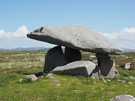
- Prehistoric sites abound. Best of them are Grianan of Aileach at Burt west of Derry, the Kilcooney tombs and Lough Doon fort north of Glenties,
- Guns and watchtowers against Napoleon were set up at many points on the coast. Best preserved are those on Lough Swilly, as they remained in later use - to 1986 at Fort Dunree near Buncrana.
- Islands: Arranmore and Tory Island are inhabited and have ferries. Gola Island has summer cottages and a ferry. Inishtrahull, 10 km off Malin Head, is the most northerly part of Ireland and is uninhabited; boat trips seldom visit as its name is Irish for "dangerously exposed landing beach, think twice!"
Do
- Theatres and cinemas are found in Letterkenny and Ballyshannon.
- Gaelic games: Donegal GAA play football and hurling at Sean Mac Cumhaill Park in Ballybofey / Stranorlar. There are some 40 club teams in the county.
- Golf courses are found all over the county, mostly links with some parkland. Examples are Ballyliffin, Murvagh near Donegal Town, and Portsalon on Fanad Peninsula.
- Trad music is found in pubs and hotel bars all over.

- Hill-walking: you need the weather, and especially the visibility. Glenties is a good base, eg for climbing Errigal.
- Glenveagh is the only national park in the county, but a good one, with scenic walks and climbs and a preserved castle that was previously a hunting lodge.
- Sea angling trips sail from many coastal villages.
- Surfing: several beaches are accessible by road but exposed to the full force of the Atlantic.
- The Wild Atlantic Way is a coastal itinerary from Inishowen Peninsula at the north tip of the county to Kinsale in County Cork, 2500 km in all. There isn't a set route, so if you're near the coast you won't be wrong. It's up to you how many peninsulas and headlands you include, whether to visit any islands or veer inland for places such as Glenveagh and Gweedore.
Events
- Donegal International Rally is an on-road car rally over 3 days in June, based in Letterkenny but touring the county. Dates and routes for 2022 are tba.
- Earagail Arts Festival is held in July at various venues across the northwest of the county. The next is 9-24 July 2022.
Eat
- Letterkenny has the widest choice of cuisines, but it's mostly cheap-and-cheerful.
- Pub grub is often the best option in the villages, especially if there's a good view.
- Seafood is a Donegal staple: Killybegs remains a busy fishing port.
- For splurge fine dining, seek out the upmarket hotels.
Drink

- Lots of pubs everywhere, often with trad music, but in 2020 and 2021 they were blighted by Covid, while those serving food could call themselves restaurants and stay open.
- Hotel bars have higher prices but usually a better choice of food. They have extended hours only for residents, as Brendan Behan once uproariously demonstrated in the Highland Hotel in Aradara.
- There's a micro-brewery in Letterkenny, a whiskey disillery in Crolly near Dungloe, and a gin distillery in Carrick towards Glencolmcille.
Sleep
- Letterkenny as the largest town has mid-range business hotels.
- Much accommodation is in small B&Bs. These were closed by covid in 2020 and 2021 because of the impracticality of distancing, and it remains to be seen how many will re-open in 2022.
- Camping and caravan sites were similarly afflicted. Many sites around the coast are just static units on long-term lets, not available to campers or tourers. The good news is that a county badly lacking yurts now has them, for instance at Portsalon on the Fanad Peninsula.

- Outstanding places are Millpark and Lough Eske Castle near Donegal Town, Rathmullen House and Frewin House on the Fanad Peninsula, Red Door in Buncrana, and Caisleáin Óir Hotel in Annagry near Dungloe.
- Consider basing in Derry for exploring the north of Donegal.
Go next
- East is the historic city of Derry. The County Londonderry coastline is scenic.
- Continue east for the big attractions of the County Antrim coast: Bushmills, Giant's Causeway, Carrick-a-Rede and the Antrim glens.
- Belfast is a fascinating destination and deserves 2 or 3 days to explore.
- Southeast is County Fermanagh, with lake and river scenery around Enniskillen.
- South you cross a thin strip of Leitrim, then the landscape becomes dramatic beneath Ben Bulben in County Sligo.
County Donegal
donegal.ieUlster
Primary administrative division