County Laois - county in Ireland
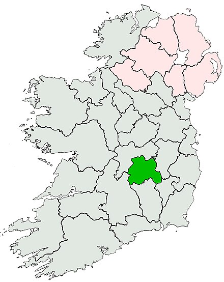
 County Laois (pronounced "leesh") (Contae Laoise) is in the East Coast and Midlands region of Ireland. Historically it was on the western fringe of Leinster, but modern transport puts it within commuting distance of Dublin, only an hour away.
Towns
- Portlaoise the county town is a transport hub. Its sights, such as Dunamase and Timahoe, are some distance out.
- Portarlington is near the grand neo-classical Emo Court.
- Abbeyleix has lost its abbey but has Heywood Gardens and a notable bog.
- Mountmellick is a base for hiking the north slopes of Slieve Bloom Mountains.
- Mountrath is near the south flanks of those mountains.
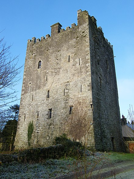
- Ballaghmore near the Tipperary boundary has a 15th century tower house.
- Carlow is of course mostly in County Carlow but straddles the boundary.
Other destinations
- Slieve Bloom Mountains 📍 (Sliabh Bladhma) form the boundary with County Offaly.
Understand
Ireland began on two continents separated by the Iapetus Ocean. Over 400 million years ago the ocean closed up, and a line of mountains formed where the continents fused. These towered over 3000 m high, but were of sandstone that quickly eroded, leaving the 500 m peaks of the Slieve Bloom Mountains. They formed a natural boundary between the ancient kingdoms of Leinster to the east and Munster to the west, and a semi-independent "buffer state" of Osraige or Ossory emerged along this upland strip. Its people were the tribe of Ui Laoighis, pronounced "Leesh", who were traditionally composed of seven "septs" or clans - the leading clan being the O'Mordha, aka O'More or Moore.
The O'Mores sided with Leinster but in the 12th century the Normans arrived, grabbed the best land, and re-organised the territory into shires or counties. But their control this far west was tenuous, they were distracted by plagues and other wars, and Laois was among the areas that repulsed them in the 13th / 14th centuries and restored Gaelic rule. The Tudors resumed the task of subduing Ireland, and in 1556 under Mary I they created Queen's County, with its county town at Maryborough. They ejected the O'Mores and colonised the area with "Plantations" of loyal English settlers, but this was a stuttering process, with Irish counter-attacks and limited numbers of incomers. There were also French Huguenot settlers in the 1690s, and Quakers from the 18th century, who developed industries such as textiles. Mountmellick for instance, now a quiet little place, once rang with the clamour of forge-mallets and looms. But it wasn't on a large enough scale to change the ethnic balance (as it did in the Ulster textile towns) or to protect against the famine years, when the population slumped.
The modern county is "double land-locked" - surrounded by counties that are themselves land-locked, if you discount tidal rivers. At independence in 1921, "Maryborough" became Portlaoise and the county unofficially became Laois, though this wasn't enshrined in law. So legally it's still "Queen's County" just as neighbouring Offaly remains "King's County" for Mary's husband, Philip II of Spain. The mountains and bogs of Laois constrain the transport routes: the railway arrived in 1847, and Mountrath became a bottleneck on the Dublin - Limerick road until bypassed in 2010. Portlaoise developed industry, but what chiefly reversed the population decline was the ease of commuting to Dublin, only an hour away by road or rail. In 2016 the county population was 84,697, a 26% increase on 2006.
The county tourist agency promotes Laois under the slogan "You're welcome". The national agency Discover Ireland covers it as part of "Ireland's Ancient East", which roughly means Leinster.
Get in

Dublin Coach N7 runs every 2 hours from Dublin Airport via Kildare to Portlaoise. From Dublin city take their M7 bus towards Limerick, and change at Kildare for the N7 to Portlaoise or the 816 to Portarlington.
Bus Éireann 73 trundles across the midlands twice a day from Waterford via Thomastown, Kilkenny, Carlow and Stradbally to Portlaoise and Mountmellick. It continues to Tullamore, Clara, Moate and Athlone.
By road from Dublin follow N7 / M7 and reckon an hour.
Get around
Train is a good option between Portlaoise and Portarlington. Bus routes fan out from Portlaoise to the county's other towns but service is sparse, often only twice a day, and attractions such as Rock of Dunamase or the trailheads for Slieve Bloom have no public transport. So you need wheels. The distances are not great so a bike would do, but a car gets you out of the rain.
See
.jpg/440px-Ballinakill_(1696493589).jpg)
- Abbeyleix has a bog that's notable even by Ireland's demanding standards, with a 3.5 km boardwalk.
- Ballaghmore Castle is a 15th century tower house. Five km away in Camross is Poet's Cottage.
- Emo Court is a 19th century neo-classical mansion 8 km south of Portarlington.
- Gash Gardens are near Mountrath, while Heywood Gardens are in Ballinakill southeast of Abbeyleix.
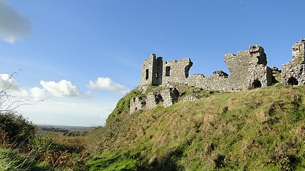
- Dunamase is a rocky outcrop and castle east of Port Laoise on the road towards Stradbally.
- Timahoe has a fine Round Tower.
Do
- See a show at Dunamase Theatre in Port Laoise.
- Stradbally Hall hosts various events such as the Electric Picnic and Steam Rally.
- Gaelic games: Laois GAA play football and hurling in Port Laoise. There are almost 50 GAA club teams across the county.
- Boating: the Barrow Navigation branches off the Grand Canal and courses south, forming the boundary between Counties Laois and Carlow. Multiple access points, the best spot for boat hire is Vicarstown.
- Buds and Blooms is a garden festival held in early June, multiple venues, with access to several gardens not routinely open to the public.
Eat

- Portlaoise
- Mayur Indian Restaurant
- Indian Prince Restaurant
- Kellty's Steakhouse
- Portarlington
- O'Deas's Bar and Bistro
- Emo
- Baton's at the Gatehouse
- Durrow south of Abbeyleix has good meals at Ashbrook Arms and excellent dining at Durrow Castle.
- Roundwood House above Mountrath is another excellent hotel restaurant.
Drink
- Lots and lots of bars in Portlaoise. A good starter is the Jeremiah Grant, named for the notorious local rustler and highwayman.
- Morrissey's in Abbeyleix is an atmospheric old pub.
- Ballykilcavan Brewery is near Stradbally and offers tours.
- A couple of distilleries produce spirits, but they're all blended into other brands' liqueurs and mixed drinks, and there are no tours.
Go next
- South is County Kilkenny. Its attractive county town Kilkenny has a wealth of sights, heritage, and amenities.
- North and west lies County Offaly: Tullamore has two famous distilleries, Birr is a charming Georgian town, and Clonmacnoise is an outstanding monastic site.
- East are the horse-rearing pastures of County Kildare and County Carlow, and then you're on the threshold of Dublin.