Slieve Bloom Mountains - mountain range in Ireland
The Slieve Bloom Mountains are a low range of mountains between County Laois and County Offaly.
Understand
 Ireland began on two separate continents: 450 million years ago the northwest was in Laurentia, and the southeast lay in Gondwana the other side of the Iapetus Ocean. This ocean closed up, to squish the land masses into the super-continent of Euramerica, with mountain building along the joint or "Iapetus suture". The Slieve Bloom mountains were among those so formed, with a base of Silurian mudstone from the ocean floor, overlain by Devonian or "Old Red" sandstone; later came limestones. They initially towered over 3500 m, but sand- and mudstones erode much faster than granite or gneiss. They're now some 400-500 m, hikes not mountain climbs, but rising prominently from the lowlands. The highest are Arderin (527 m) at the southwest end of the range and Baunreaghcong (511 m) northeast. The ridge forms a natural boundary between Counties Offaly and Westmeath, with a corner in Tipperary near Roscrea.
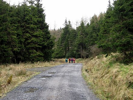
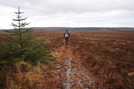
The terrain is too steep for farming so the slopes are forested with commercial conifers, with lanes for truck access that are firm going but with views closed in by the trees. The tops are open heath and bog. There's a 75 km three-day trail you can do, but most visitors day-trip. The mountains aren't a designated "park" but Slieve Bloom is the umbrella tourist promotion for this area.
Towns
- Kinnitty 📍 is the main west-side base: it has accommodation (some of it swish) and, should you seek one, a pyramid.
- Cadamstown 📍 nearby lacks accommodation but is the start of trails.
- Mountmellick 📍 has a few visitor amenities and is near the north trailheads. .
- Mountrath 📍 is the main approach from the southeast.
- Portlaoise is a workaday place but as the county town has lots of accommodation.
Get in
By road from Dublin follow N7 / M7 towards Portlaoise: reckon an hour, though the first section out of the city hasn't been upgraded to motorway. For north and west slopes, leave at Exit 15 at Emo and take R422 for Mountmellick and Kinnitty. For south slopes, stay on M7 to Exit 18 then follow R445 into Mountrath.
The trails start from above those villages.
Get around
You need wheels to reach the trailheads.
See
The ten highest peaks, from southwest to northeast, are:
- Garraunbaun 📍 406 m / 1332 ft
- Farbreague 📍 430 m / 1411 ft
- Arderin 📍 at 527 m / 1729 ft is the highest
A narrow public lane crosses the range through Glendine Gap between Arderin and Barcam, giving easy access to both.
- Barcam 📍 484 m / 1588 ft
- Carroll's Hill 📍 482 m / 1581 ft
- Stillbrook Hill 📍 514 m / 1686 ft
- Castleconor 📍 407 m / 1335 ft
- Wolftrap Mountain 📍 487 m / 1598 ft
- Baunreaghcong 📍 511 m / 1677 ft
- Ridge of Capard 📍 483 m / 1585 ft
Do
- Glenbarrow 📍 walks include a 4 km walk along the River Barrow taking in the Glenbarrow Waterfall and the 10 km Old Mill Loop.
- Kinnitty walks include a 4 km loop through Kinnitty forest passing Kinnitty Castle and the 8 km Glinsk Castle loop. Also north side are the 8 km Brittas Loop and the 6 km Ricket's Rock Loop.
- Cadamstown walks include the 7 km Silver River nature trail, the 8 km Paul's Lane Loop and the 14 km Giant's Grave loop.
Eat
 There are no facilities in the mountains to eat, drink or shop, and no accommodation, see the nearby towns. Portlaoise has the best selection all round.
Wild camping is tolerated - the upper reaches of Glenregan above Kinitty are a common spot - but you may not light fires.
Go next
Near the east coast rise the Wicklow mountains, of similar height, and with a long-distance trail the Wicklow Way.
Slieve Bloom Mountains
Date Time:Please wait...Timezone:Europe/DublinCoordinates:53.10, -7.57
County Laois
2nd-order administrative division
Leinster
Primary administrative division