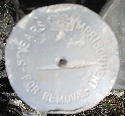
Four Corners (Canada) - quadripoint in Canada, between Manitoba, Saskatchewan, Northwest Territories and Nunavut

The Four Corners monument is an example of a quadripoint, i.e. a point on the Earth that touches the border of four jurisdictions, around 60°N 102°W.
There is another Four Corners in the United States.
Understand
At this point, the provinces of Saskatchewan and Manitoba, and the territories of Northwest Territories and Nunavut meet. It came into existence when Nunavut was created out of the Northwest Territories in April 1999.
The four corners area is located between Kasba Lake to the north and Hasbala Lake to the south. It is near an area of marginal taiga forest.
Get in
Reaching this point involves significant logistical challenges and requires advance planning. It is hundreds of kilometres from any road or railway.
From Saskatchewan
This is the most feasible approach to the Fours Corners. From La Ronge, drive 435 km north on Saskatchewan Provincial Highways 102 and 905, which are gravel roads, to Points North Landing, which is the nearest float plane facility. Hasbala Lake is about 225 km by air from there.
From Points North Landing, catch a freight flight to Hasbala Lake Lodge, which you've arranged well in advance. The flight will take about 1 hour and 45 minutes, depending on the aircraft and conditions.
At Hasbala Lake, take a fishing boat about 2½ km across the lake, then walk several hundred meters through muskeg and mosquito swarms to the monument.
Contact Hasbala Lake Lodge (June to August) for help with air, boat, and guide services. See the listing in "Sleep" below.
From Northwest Territories
Another option would be to contact Kasba Lake Lodge (see listing in "Sleep") in the Northwest Territories. It operates Kasba Lake Airport, and Kasba Lake Water Aerodrome. The Fours Corners are a kilometre or so from the shore of Kasba Lake. You would have to make arrangements with the lodge for transportation across the lake.
- Kasba Lake Airport (IATA: YDU), 60.291944°, -102.501944°. 2019-07-17
From Manitoba
This the most challenging approach. The nearest airport with scheduled flights is in Lac Brochet (IATA: XLB), Manitoba, approximately 158 km (98 miles) away. Lac Brochet is a First Nations (Indigenous) reserve with a population of about 800 people.
- Perimeter Aviation. The only scheduled flights to Lac Brochet. From Thompson, Manitoba, via Brochet or Tadoule Lake. The flight is 1-2 hr, depending on stops, and a round-trip ticket will cost $600-700. 2019-05-30
From Lac Brochet, you can get about 8 km (5 miles) closer to the monument by driving. From then on however, there are no roads or paths that lead here, making hiking the only viable option.
It is at least 200 km through the wilderness (as the crow flies), crossing countless lakes and rivers. This should not be attempted by inexperienced hikers, and requires careful planning. See Wilderness backpacking and Orienteering to get started.
Get around
See Hiking. You'd have to do a lot of it.
See

Do
Once you're here you can take a picture of yourself in 2 provinces and 2 territories.
Buy, eat and drink
Bring everything you need from Lac Brochet or Thompson. Lac Brochet has one store, the Northern Store, which likely has limited stock and is expensive. Lac Brochet has no hotel. You should bring camping and hiking gear with you, or buy it in Winnipeg before you leave for Thompson.
Sleep
Coming from Lac Brochet, there are no campsites or accommodations. See Wild camping.
- Kasba Lake Lodge, 60.202636°, -102.588862°. A fishing lodge on Lake Kasba in the NWT. They arrange charter flights (2½ hr) from Winnipeg to the airport they operate. 5-day fishing excursions US$4500 plus tax including flight, meals, boats, guide 2019-05-30
- Hasbala Lake Lodge, +1 602 908 1532, ron@hasbalalake.com. The obelisk is about 1.5 km from this fishing lodge, and it is a regular visit for their guests. 5-day fishing packages from US$3300 return, including taxes, flights from Saskatoon, meals, boats and guide 2019-05-30
Stay safe
The monument is remote, and the surrounding land within hundreds of kilometers consists almost entirely of uninhabited forests and lakes, making it possible for you to come face to face with dangerous wildlife such as black bears. Also, expect lots of mosquitoes.
The remote location means that it is extremely unlikely you will receive quick help in an emergency.
Four Corners
Timezone:MultipleCoordinates:60.00, -102.01