Swedish Empire
Swedish Empire
The Swedish Empire was at its greatest extent in the 17th and early 18th centuries. The only Nordic country to have been considered a "great power", at points in history Sweden has controlled most of the shores of the Baltic Sea, troops have marched deep into present-day Germany, Russia and Ukraine and it has possessed colonies in North America, Africa and briefly in India.
Understand
See also: Nordic history
_en2.png/440px-Swedish_Empire_(1560-1815)_en2.png)
The term "Swedish Empire" is not universally defined, but usually seen as equivalent with the Great Power era (stormaktstiden), from 1611 (Gustavus Adolphus' ascension to the throne) to 1718 (death of Charles XII), when Sweden was as its height of power and land area. In Swedish, Sweden was at the time called Konungariket Sverige (the Kingdom of Sweden). A much more modern term is Östersjöväldet, "the Baltic Sea realm". European provinces with non-Swedish population, such as those in Finland and the Baltic states, were not colonies, but formally on par with the Swedish provinces, with extensive autonomy for the estates (stånd), who consisted of nobles, clergy, burghers, and land-owning farmers.
No Swedish monarch called themselves "emperor". Every monarch from Gustav Vasa to Gustav VI Adolf (dead 1973) was styled Sveriges, Götes och Vendes konung, "King of Sweden, Geats and Wends". The Geats, inhabitants of Götaland, have been seen as equivalent of the Goths, one of the Germanic tribes that replaced the Roman Empire. The Wends were a Slavic tribe in Pomerania, who were assimilated by the Germans in the 16th century. They were seen as the same as the Vandals, another Germanic tribe that sacked Rome. The reigning king Carl XVI Gustaf is the first monarch to be modestly styled Sveriges konung ("Sweden's king").
Medieval Sweden
See also: Vikings and the Old Norse
The period from the 8th to 11th century is known as the Viking Age, for the Norse people who travelled overseas for trade, piracy and settlement. Most Scandinavians however remained sedentary; in this period, Sweden became a unified monarchy, with the pagans converting to Christianity over time. Swedish kings annexed today's Finland in the 12th century. From 1397, all Nordic countries were unified in the Kalmar Union to counter Hanseatic influence in the Baltic Sea. In practice Denmark was in charge of the union, something that Swedish nobility wasn't happy with (leading to several minor rebellions). In 1520, when Christian II, King of Denmark was crowned King of Sweden he wanted to show he wasn't to be messed with and immediately ordered Swedish anti-unionists to be rounded up and publicly executed. This had the opposite result, leading to the Swedish War of Liberation, and the establishment of a Swedish state.
16th century: Independence and reformation
The election of Gustav Vasa (Gustav I) as king in 1523 marked the beginning of independent Sweden. Gustav Vasa made the crown hereditary, consolidated power, and brought the Protestant Reformation to Sweden. His taxes and expropriation of church property caused uprisings, which were brutally crushed. Gustav's heirs spent the second half of the century fighting Russia, annexing Estonia.
17th century: Sweden as a Great Power

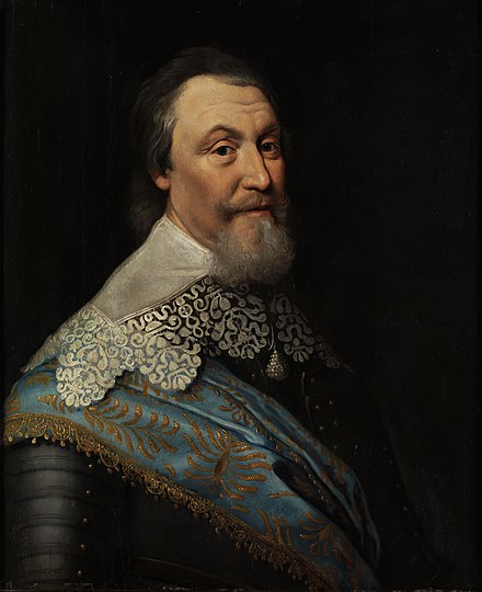
Sweden entered the Thirty Year's War to support the Lutheran cause, and the Swedes advanced deep into Germany. One of the most famous events in this war was the 1632 Battle of Lützen where King Gustavus Adolphus was killed. The anti-Habsburg coalition (including Sweden) was victorious and the war established Sweden as a major regional power in northern Europe, beginning "the Era of Great Power" (stormaktstiden). Swedish troops besieged and conquered many towns leading to local names of geographical features like "Schwedenschanze" ("Swedish redoubt").
During the 17th century, universities were founded in Tartu (1632), in Turku (1640) and in the newly conquered Lund (1666), and many towns were founded in Österland (Finland); the "time of the count" (Per Brahe) was long remembered in Finland as the good time, as was "the Swedish time" in Estonia.
Similar to many other European powers, Sweden also established a colonial empire outside Europe. Like the Dutch, they consisted mainly of various trading posts rather than control over large tract of land. In general, these projects were short-lived. In the present-day United States, along the Delaware river, the colony of New Sweden was established in 1638, as the first permanent European settlement in that area. In the same era, Sweden also had a colony called the Swedish Gold Coast in today's Ghana made up of some forts and "factories" (trading posts).
While Sweden had outposts in West Africa since the 17th century, they would not become involved in the Atlantic slave trade until a century later, when they gained possession of the island of Saint Barthelemy in the Caribbean. They held the island from 1784 to 1878, and it was first envisioned as a place for farming (and tropical fruits and tobacco were grown here on a small scale) but the island was most notable as a trading point, and a notable part of the "goods" was slaves. At the end of the Napoleonic Wars, nearby Guadeloupe was Swedish for a short period. For an even shorter period in time, in 1733, the Swedish East India Company operated a "factory" in Parangipettai, in the Cuddalore District in southeastern India.
18th century: Liberty and wars with Russia
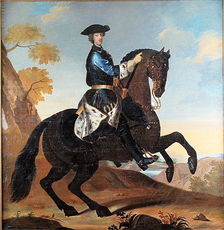
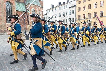
The Great Northern War broke out in 1700 with Sweden against a grand alliance of Russia, Denmark-Norway, Saxony and Poland-Lithuania. The Swedes led by king Charles XII (Karl XII, latinized form Carolus XII) were first successful, and like two later empires (Napoleon's France and Nazi Germany) the Swedish army (Caroleans) marched far into Russia before being defeated at Poltava. The war went on for 21 years, leading to a Swedish defeat, with Russia annexing Sweden's Baltic provinces.
The mid-18th century period following Charles XII's death is known as the Age of Liberty (Frihetstiden), as much of the monarch's power was transferred to the riksdag (parliament). Sweden became prominent in the arts and sciences, with celebrities such as Carl Linnaeus, the inventor of systematic biology, and Anders Celsius, who gave his name to the Celsius temperature scale. The 1766 Free Press Act was the world's first of its kind, an achievement of Anders Chydenius from what today is Finland, whose book on economic liberties predated Adam Smith's Wealth of Nations by a decade. The Age of Liberty is held to have ended with King Gustav III's coup in 1772, as he tried to make himself a despot inspired by the Enlightenment.
.png/440px-Gustav_III_by_Alexander_Roslin_-_torso_(Nationalmuseum,_15330).png)
19th century: Union and nationalism
The unlucky kings
The four Swedish kings from the House of Holstein-Gottorp all met tragical fates. Adolf Frederick was a friend of good food and died of a seizure after a huge meal; he's known as the "King who ate himself to death". Gustav III, his oldest son and next king, was shot by an assassin at a ball and died two weeks later. He was succeeded by his son, Gustav IV Adolph, who was dethroned in a military coup and deported together with his family. His uncle, Charles XIII reigned for a few years but was suffering from bad health and died without a heir.
Sweden's resistance against Napoleonic France caused Russia to defeat Sweden in the 1808-09 Finnish War and annex Finland. In the Kiel treaty of January 1814, Sweden ceded its German territories to claim Norway, which had for centuries been part of Denmark. As Norway declared independence on 17 May the same year, Sweden invaded in November, and enforced the Swedish-Norwegian Union. That was Sweden's most recent war until today.
The nationalist movement of the 19th century included the search for a common past. Swedish writers and artists romanticized the long-lost Swedish Empire, creating many of the statues, paintings, songs and books which have come to illustrate the period. Norway sought its roots in its Viking Age monarchy, and called for independence. Norway's secession from the union in 1905 marked the end of Swedish imperialism, and the settlement of Sweden's current borders.
Finland, a subject of the Russian Empire since 1809, also saw a wave of nationalism in the 19th century, to build the nation that was "raised to the status of a nation among nations" (as emperor Alexander declared). The nation building was mainly run by scholars of the Swedish-speaking minority, but they sought to find the uniquely Finnish in the nature, people and culture of the country. While some thought a nation needs one common language, others saw the Swedish language as a crucial tie to the west, and indeed the law, language and religion inherited from Swedish times gave a solid ground for the new nation, helping to withstand Russification in later years. The ties to the Nordic countries were very important also during the Cold War. To this day, Swedish remains one of Finland's two "national languages" (alongside Finnish; in contrast to the recognised minority languages). The 19th century romantic nationalism also saw the compiling of the Kalevala, often called Finland's "national epic" by Elias Lönnrot. The work, which contains several references which are cryptic even to the modern-day expert, served as one of several sources of inspiration of J.R.R. Tolkien (who admired the Finnish language and spoke it passably) and through subsequent "high fantasy" writers borrowing concepts for the modern western genre of fantasy as a whole. In the postwar decades, thousands of Finns moved to Sweden for work, and make up Sweden's largest ethnic minority since then.
A Scandinavian union between Sweden, Norway and Denmark (which included Iceland and Greenland) with Finland as a potential member was considered in the mid-19th century to stave off foreign threats, but never made real.
Inventor Alfred Nobel's final will established the Nobel Prize with a clause to reward the most deserving candidate regardless of nationality, "whether he be Scandinavian or not". By Nobel's death in 1896, this internationalist statement was provoking, as philanthropists were expected to serve their own people. Since then, the Nobel Prize has brought more fame and prestige to Sweden than any domestic award would have brought. According to Nobel's will, the Peace Prize is awarded by a committee appointed by the Norwegian Parliament, which was then a domestic legislature within the Swedish-Norwegian union.
Though the Nordic countries ended up in very different alignments during World War II in Europe and the Cold War, the region is more integrated than ever in the 21st century, without the imperialist ambitions and wars of the past.
Destinations
Sweden
-
Stockholm, 59.33°, 18.07°. Ever since Sweden was unified around AD 1000 its capital has been in Uppland; Birka, Sigtuna, Uppsala and finally Stockholm. The Old town contains the Royal Palace and other royal and governmental buildings, and many museums. See the Stockholm history tour itinerary for a walk through the great events of Swedish history, and Stockholm quay palace tour for the grand houses of nobles and businesspeople.
-
Royal Palace (Kungliga Slottet), 59.32688°, 18.07028°. Built between 1697 and 1754, dominating the north-eastern part of the Old Town, the Royal Palace is open to the public unless used for state ceremonies. Entrance ticket includes The Royal Apartments, the Tre Kronor Museum, the Treasury, and Gustav III's Museum of Antiquities.
-
Army Museum (Armémuseum), Riddargatan 13, 59.33470°, 18.08030°. Displays Sweden's military history, with emphasis on the Swedish Empire. The museum makes a great effort of putting warfare into a broader social context.
-
Riddarholmen Church (Riddarholmskyrkan), 59.32465°, 18.06461°. Riddarholmen is the ancient core of Stockholm and this is the city's oldest building - though no longer the oldest church, as it's nowadays simply a museum. Built as an abbey in the late 14th century. Fifteen Swedish monarchs are buried here, from Gustavus Adolphus to Gustav V. Queen Christina is notably absent; her grave lies in the Vatican.
-
Vasa Museum (Vasamuseet), Galärvarvsvägen 14 (Stockholm/Djurgården), 59.32807°, 18.09139°. The Vasa was a warship built for the Thirty Years War which sank in Stockholm Harbour on its maiden voyage in 1628, during the heyday of Swedish Empire. Salvaged in 1961, the ship is almost wholly preserved, and is the only one of its kind and quality in the world. The museum contains several side exhibitions: full-scale models of the people whose bodies were found in the ship hulk, as well as wooden sculptures, the world's oldest preserved sail, and other salvaged objects.
-
Drottningholm Palace (Drottningholms slott), 59.3217°, 17.8869°. The Royal family lives at Drottningholm Palace on the Lovön island in Lake Mälaren. Drottningholm is one of three world heritage sites in Greater Stockholm. The 18th-century palace is beautiful, and much of it is open to the public. The surroundings are well worth a walk as well. Back in the 18th century it was fashionable among the nobility to own and display exotic items from faraway lands, and on the palace grounds there's a Chinese Pavilion named Kina slott. It's built in "Chinese style" has items from the Far East imported by the Swedish East India Company on display.
-
Uppsala, 59.8588°, 17.6372°. Uppsala, a political and religious centre since the 5th century BC, was the Swedish capital in Catholic times experienced a decline after the Reformation when the clergy lost its power to the king. After the Thirty Years' War the city was revived, and with its university (the oldest in the Nordic countries) became a kind of intellectual and scientific capital of Sweden it still is today. 2020-08-17
-
Uppsala Castle (Uppsala Slott), 59.85344°, 17.63564°. This major Uppsala landmark is stocked with large halls, paintings, and older remnants of the 16th-century castle built by the Vasa dynasty as a royal residence and a military fortification. As the castle was damaged in the 1702 city fire, the current building is smaller than it was in the 17th century, but is nevertheless built in the same style. Today it is the official residence of the governor of Uppsala county, and houses several museums. Due to its location on the top of Uppsalaåsen the Castle area offer some of the best views of Uppsala. 2018-03-17
- Vasaborgen (The Vasa Castle ruins), Kung Jans port, NA°, NA°. The 16th-century parts of Uppsala castle damaged in the 1702 fire. Among other things the ruins contain the dungeons where the 1567 "Sture murders" took place. 2018-10-03
-
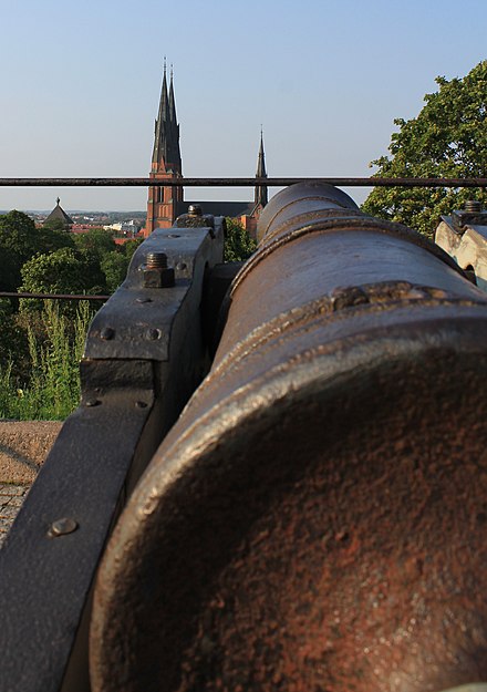
Uppsala Cathedral (Domkyrkan), Domkyrkoplan 2, 59.8581°, 17.6336°. Uppsala Cathedral, built during a century and a half between 1272 and 1435 in Gothic style, is one of the focal points of Uppsala and it dominates the city skyline. It is the largest church in the Nordic countries, the burial site of many Swedish royals, and the seat of the Church of Sweden. Here you can see relics of Eric the Holy and Saint Bridget, and in the far end of the cathedral you will find "Vasakoret" – the royal crypt of Gustav I Vasa. The walls of the crypt are covered in national romantic frescoes depicting Vasa's reign and his war for Swedish independence. Other notable burials include the 17th-century polymath Olaus Rudbeck, Carl Linnaeus, the 18th-century mystic Emanuel Swedenborg and the theologian, archbishop and Nobel peace prize laureate Nathan Söderblom. Free 2018-10-03
- Skattkammaren (Treasury Museum), NA°, NA°. In its northern tower, the Uppsala Cathedral exhibit highlights from its collection. The collections include plenty of royal regalia used in the many coronations which took place in the Cathedral. They also exhibit one of the finest collections of historic textiles in the world, including the world's only preserved medieval feast dress, used by Queen Margaret of the Kalmar Union. Another exceptional, but somewhat gruesome exhibit, is the clothing worn by three members of the Sture noble family when they were massacred by the insane King Eric XIV in Uppsala in 1567. Despite being covered with visible stab-wounds and blood stains, these are the best-preserved 16th-century male feast dresses in the world. 2018-10-03
-
Falun, 60.6072°, 15.6323°. Falun is famous for its world heritage listed copped mine that operated from the middle ages until 1992. During the imperial times, this 3,000 tons of copper was mined here every year, providing 2/3 of the copper used in Europe and so the Falun Mine was a major source of income for the expanding empire. 2020-08-17
-
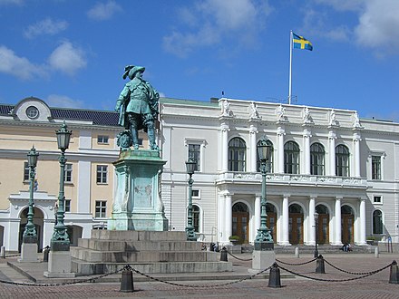
Gothenburg (Göteborg), 57.72°, 11.98°. As Sweden had expanded westwards in the early 17th century, king Gustavus Adolphus decided to establish a city on the west coast. Due to the swampy terrain the city was built around canals, like Dutch cities, and with Dutch experts. The Dutch inhabitants would also develop and dominate the city politically for its first few decades. Today some of the canals have been turned into streets. Gothenburg became an important gateway and trading point, as ships now had access to the seas without having to sail through the Danish sounds. The Swedish East Indian Company was founded here, and its imposing head office building today serves as the city museum. 2020-08-15
-
Gothenburg City Museum (Göteborgs Stadsmuseum), Norra Hamngatan 12 (Gothenburg), 57.70632°, 11.96346°. Covers the history of the city and region from prehistoric times to the present, with emphasis on the 19th-century Swedish East India Company, which was once housed in the building. 2019-11-17
-
Vadstena Castle, 58.445915°, 14.883545°. From the 16th century, it was built as a fortress to protect the rich Mälaren Valley from the southern enemy. Rebuilt into a Renaissance palace by the royal Vasa family and since then very well-preserved. Guided tours are offered all year. Museum with furnishings from 16-18th centuries.
-
Visby, 57.635°, 18.300°. Founded in the middle ages, the city changed hands between Danes, the Hanseatic league, Teutonic Knights and pirates, being sacked and burnt down several times. In 1645, after the Second Treaty of Brömsebo, Gotland, Jämtland and Saaremaa became part of Sweden. Gotland lies at a strategic position in the Baltic Sea, and as such the Swedish military maintains a presence here to this day.
-
Lund, 55.70°, 13.20°. Like Uppsala, Lund is also famous for its cathedral and university, and for being one of the oldest cities in the country (founded approximately 990, near the settlement of Uppåkra, which in turn is believed to date to the 1st century BC). However this medieval city was part of Denmark until 1658, when Scania including Lund became part of Sweden, and the university was established shortly afterwards to promote Swedish language and culture in the newly conquered city.
-
Karlskrona, 56.17°, 15.60°. Founded in 1680 by Charles XI, as a naval base that was ice-free almost around the year as well as close to Denmark and continental Europe ("continental" used in the Scandinavian sense as everything south of the Baltic Sea). It's still an important city for the navy, but there were much bigger plans back in the day – it was intended to become the new capital, which is visible in the grand Baroque buildings and squares, that have earned the city a place in the world heritage list. The city's name literally translates to "Charles' crown" and it quickly grew to the third most populous city in the empire after Stockholm and Riga. Nevertheless, as Sweden's domination in Northern Europe faded away, so did the importance of Karlskrona.
-
Karlskrona Maritime Museum, Stumholmen, 56.160795°, 15.598943°. A very large maritime museum on the waterfront with spectacular vistas. Most of the exhibits are in Swedish, so be sure to pick up an audio guide. The exhibits consist principally of a very large and impressive collection of wooden ship models, and life-size interiors of ships that can be walked through. In addition to the museum itself, the complex houses a very popular smorgasbord that you'll find packed with Swedes from around 11:30 onwards, and a gift shop. Outside the museum you'll also find some disused ships/submarines that are worth a look, and Karlskrona's famous lighthouse. Price: 170/130 kr for adults in the summer; free in the winter.
-
Vaxholm Fortress (Vaxholms fästning), 59.402827°, 18.359515°. A fortress which has guarded Stockholm's harbour since the 16th century, and famously resisted an attack by the Russian Empire in 1719. Over the centuries, an extensive coastal defense system was built across the archipelago, with Vaxholm as its headquarters. Since 2003, the fortress has a museum of its history, as well as hospitality venues.
-
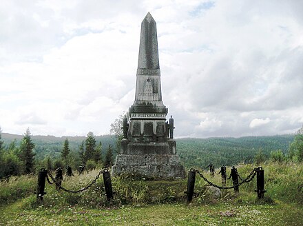
Carolean monument (Karolinermonumentet), 63.3915°, 12.8750°. The attempted invasion of Norway in the Great Northern War failed, and as news about the death of the king in Halden reached the Swedes in Trondheim, they marched back across the mountains after Christmas 1718, in what would become known as the Carolean Death March. They were caught in a snowstorm on Øyfjellet mountain, and only about 2000 of the 6000 men leaving Trondheim made it to the Swedish side. In the village of Duved there's a monument to the fallen. 2020-08-16
-
Örbyhus Castle (Örbyhus slott), 60.199990°, 17.709175°. In 1577 the Swedish king Erik XIV died during his imprisonment here. According to legend he was poisoned through a plate of pea soup! The Castle area is free. Guided tours are 60 kr
-
Västerås Castle (Västerås slott), 59.606389°, 16.544444°. Famous for the Parliamentary decision of 1527 when King Gustav Wasa abolished Catholicism in Sweden, making Sweden a protestant country. The Västerås castle was erected around 1200, but what is seen of the castle today was built by Gustav Vasa mid-1500. The castle is a rather ugly building clearly meant for defence and not to impress by look. Nowadays it contains a conference hall, restaurant and a minor exhibition.
-
Västerås Cathedral (Västerås Domkyrka), Västra Kyrkogatan 6 (Västerås), 59.612528°, 16.54125°. The oldest parts of the cathedral were built around 1200. The oldest son of Gustav Vasa, Erik XIV, is buried in the church. Erik XIV is mostly famous because he was killed by poisoned pea soup. Summertime appointments for guided tours can be made between 11:00 and 13:00 at the tourist office.
-
Kalmar Castle (Kalmar Slott), 56.658044°, 16.355279°. A 12th century castle, where the Kalmar Union was formed in 1397. During the Swedish War of Independence, Swedes commanded by Anna Eriksdotter Bielke defended the castle and city against Danish incursions until having to surrender in August or September 1520. After war damage and a fire in 1642 the castle fell into disrepair but was reconstructed in the late 19th century.
-
Karlshamn, 56.170°, 14.863°. The other 17th-century city in southeastern Sweden to be named after a king Charles. After the treaty of Roskilde when Blekinge became part of Sweden, Charles X Gustav decided to establish a harbor at this place. A fort was set up in 1659, and a town was established by royal charter in 1664, the same year the king passed away. It was named Karlshamn (Charles' harbor) after him two years later. Today it's an industrial small town and a notable port. 2020-09-22
Finland
 Finland was part of Sweden from the 12th century until 1809; neither a colony nor a foreign territory, but one of the four "lands" (Österland, lit. Eastland – on par with Götaland, Svealand and Norrland), with delegates from present-day Finland at the riksdag.
Many Finnish cities were founded by Swedish kings and governor-generals, and the Swedish heritage is visible and alive. Swedish remains one of Finland's two official language, with around 300,000 Swedish-speaking Finns (finlandssvenskar), most of them living in the coastal provinces and in the archipelago including Åland.
Attractions from the Swedish period here tend to be less pompous than in Sweden (for instance the castles in present-day Finland are more of fortifications). Aside of the southeastern part of "Österland", nowadays part of Russia, this part of the Swedish realm saw little warfare until the 18th century.
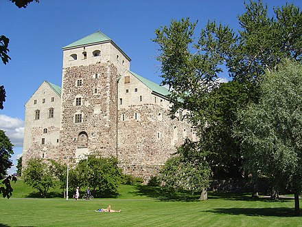
- Turku (Åbo), 60.45°, 22.26°. Turku is the oldest city in Finland and was founded in the early 13th century (first mentioned in 1229). During Swedish times it was the biggest city as well as the administrative seat of the area. The name Finland originally referred to just the region around Turku, today this region is known as Finland Proper (Fin. Varsinais-Suomi, Swe. Egentliga Finland). Two of Turku's top sights are from the Swedish time; the castle and the cathedral. The massive 1827 fire destroyed much of the city (including damaging the cathedral), though the district of Luostarinmäki/Klosterbacken, now an open air museum, was spared. 2020-08-15
- Porvoo (Borgå), 60.39°, 25.66°. Porvoo, the second oldest Finnish city was first mentioned in a text from 1351. Burned by pirates and Russian troops and being officially disestablished (in order to get people to move to newly established Helsinki), it finally became an important trading point on the Finnish south coast in the 17th century. Also, when Vyborg with surroundings were ceded to Russia after the Great Norhtern War, the bishops seat and middle school were moved here. When Finland became part of Russia in 1809, the Diet of Porvoo was held in the city hall, where the Grand Duchy of Finland was established. 2020-08-15
- Hamina (Fredrikshamn), 60.565°, 27.188°. A look at a city map reveals old Hamina has a city structure unique for Finland. It's laid out as a bastion, because it was founded in 1723 as a border fort against Russia after the Great Northern War when the border had moved west. The Swedish king of the time was Fredrik I, and the city was named after him; Fredrikshamn translates to Fredrik's harbor. 2020-08-15

- Olavinlinna (Olofsborg), 61.8639°, 28.9010°. Medieval Olavinlinna is the city's symbol and main attraction. Built in 1475 by Danish knight Erik Axelsson to protect the eastern border of the Swedish-Danish Kalmar Union, it was named after the patron saint of knights, St. Olaf. The Russians were soon on the offensive, but the castle withstood several sieges before surrendering in 1714. The Swedes recaptured it in 1721, but lost it again in 1743, and it stayed in Russian hands until Finnish independence in 1917. This also explains why it has stayed in such good shape: for the Russians, it was far inland and militarily useless, and hence not a target for the enemy either. Today, Olavinlinna is the world's northernmost medieval stone castle and said to be Finland's best-preserved and most beautiful castle. There are two small museums inside the castle: the Castle Museum for the castle's history and the Orthodox Museum with Russian Orthodox Christian icons and paraphernalia.
- Suomenlinna (Sveaborg), 60.1451°, 24.9866°. The "Gibraltar of the North" was once the greatest sea fortress in the Baltic, built by Sweden in the mid-1700s at great expense to protect their eastern flank. When the Russians invaded in February 1808, the bulk of the unprepared and bankrupt Swedish army hastily withdrew, allowing the Russians to conquer Helsinki without a fight and besiege the fortress. With no reinforcements in sight, commander Carl Olof Cronstedt surrendered unconditionally two months later, and Finland was ceded to the Russians. Cronstedt's actions probably saved countless civilian lives, but King Gustav IV needed a scapegoat and sentenced him to death for treason; fortunately, the losing king was himself soon overthrown, and Cronstedt lived out his years gardening. Today's Suomenlinna is still living in its own time with only old buildings, few cars, fewer than a thousand inhabitants and lots of old fortifications, catacombs and cast iron cannons.
Norway and Denmark
Following Sweden's independence, Denmark (and Norway, part of the union until the Napoleonic wars) and Sweden remained enemies for several centuries; several wars were fought between them, or between different alliances where Denmark and Sweden would join opposite sides. In 1814, Denmark was forced to cede Norway to Sweden in the midst of the Napoleonic Wars. Norway was ruled by the Swedish king until 7 June 1905, when the union was dissolved and Norway gained full independence with its own separate king.
-
Kristiansten Fortress (Kristiansten festning), 63.4269°, 10.4106°. Small fortress on a hill overlooking the centre. Have a walk in the area for good views of Trondheim. If you can't be bothered with the hills, get bus 63 to Ankersgata, or rent a bike and use the bike lift! The only time the fortress has been in use was when the Carolean troops tried to invade Norway in late 1718.
-
Fredriksten fortress, 59.1198°, 11.3968°. This is where the Swedish king Charles XII was killed - in 1718 - during the Great Northern War between Sweden and Norway, at that time a province of Denmark.
-
{{see | name=Skibsklarergaarden | url=http://www.museerne.helsingor.dk/skibsklarerergaarden.aspx (dead link: December 2020) | email= | address=Strandgade 91 | lat=56.034763 | long=12.615075 | directions=Elsinore | phone= | tollfree= | fax= | hours= | content=The city's, if not the country's best preserved merchant house from where they used to handle the paperwork for the Øresund tolls and supply foreign ships with provisions for the onward journey. It hails back to the 16th century, while the current building overlooking the harbour is from 1780. Nearly all the interior is original, and there is also a small shop which sells samples of some of the original items sold here. }}
-
Roskilde (treaty), 55.645°, 12.084°. In the Second Northern War, the Swedes were fighting against the Polish-Lithuanian Commonwealth near Warsaw, when Denmark declared war. The troops then marched west, took Jutland, and in February of 1658 marched across the belts that were frozen over (this was during the Little Ice Age). As the Swedes led by Charles X Gustav were at the gates of Copenhagen having taken virtually all of present-day Denmark, they could set forth hefty demands in the peace negotiations in Roskilde. Sweden received the provinces of Scania, Blekinge, Halland permanently, Bohuslän as well as Trøndelag and Bornholm that they would return two years later. 2020-08-15
Baltic countries

Northwestern Estonia had a Swedish minority since the Middle Ages, and despite repressions, deportations to Ukraine and emigration to Sweden during Russian rule, a few of them remain, as one of very few endemic Swedish communities abroad. They are known as aibofolke ("island people" in ancient Swedish), or rannarootslased ("coastal Swedes" in Estonian).
Swedish Livonia was seen as an important dominion from the beginning on, and the rich city of Riga as a big prize. Here the Swedes established many institutions such as the general government, a local parliament, law courts, educational institutions, a land surveying institute and a national bank.
-
Hiiumaa (Dagö), 58.86°, 22.70°. Controlled by Sweden from 1563 to 1721, though the first Swedes settled here already in the 13th century. During the Swedish era, the island was an important center for Estonian Swedes. Back then the capital of the island was Hohenholm (Kõrgessaare in modern Estonian). After the Great Northern War, when the island became Russian, the Swedish still retained many of their rights. Although some emigrated to Sweden, and others were deported to Gammelsvenskby in Ukraine (see below) in 1781, there were still 2000 living on the island at the end of the 18th century. The following exodus took place after WWII, when Estonia became part of the Soviet Union. But some people identifiying as Swedes still live on Hiiumaa, and the local dialect of Estonian has influences from Swedish. 2020-08-15

-
Vormsi (Ormsö), 58.999°, 23.270°. The western Estonian island that has the most visible Swedish heritage today. Almost all villages and settlements have Swedish names, and about 300 of the island's 400 inhabitants claim Estonian Swedish ancestry. A notable building from Swedish times is the Lutheran church in Hullo village. 2020-08-20
-
Haapsalu and Noarootsi, 58.939°, 23.544°. The Haapsalu region and the Noarootsi peninsula to the north were the most important mainland settlements of the coastal Swedes. Like the rest of northwestern Estonia, the city and the region was controlled by the Teutonic Order until 1581 when the Swedes marched in. Parts of Haapsalu castle was built during Swedish rule, though overall this era meant a bit of a decline for the city. It was largely destroyed in the Great Northern War, but eventually rebuilt as a resort city. 2020-08-20
-
Museum of the Coastal Swedes (Rannarootsi Muuseum), Sadama tn 31 - 32 (Haapsalu), 58.955737°, 23.528194°. The museum introduces the thousand-year-old settlements of the coastal Swedes in Estonia. In the house inaugurated by the King of Sweden, you can acquaint yourself with their unique cultural heritage and see a 20-metre embroidered rug that depicts the life of the Estonian-Swedes.
-
Saaremaa (Ösel), 58.40°, 22.53°. Kuressaare, Saaremaa's capital was established by the crusaders. The island was one of the last parts of the Baltic states Sweden got control over, after the Treaty of Brömsebo. Saaremaa too had Swedish inhabitants since the middle ages, and there are some placenames showcasing this, but this heritage is much less pronounced than further north. 2020-08-15
-
Tallinn, 59.43°, 24.74°. Tallinn too was already a well established city, and the world heritage listed old town generally dates from the times before the Swedish era, but the Swedes did control it for a century and a half. For an European city that has been ruled by several powers over the centuries, Tallinn's medieval old town has survived very well and doesn't differ too much from what it looked like as a Swedish city. Head to St. Mary's cathedral to see the graves of some prominent Swedish military from that time. 2020-08-15
-
Narva, 59.37°, 28.20°. Narva, today at the Estonian-Russian border, was the site of many military confrontations between Sweden and Russia. After a failed attempt two years earlier, the Swedes took the city and its fort in 1581. At that the Swedes also conquered Ingria. During the 17th century Sweden fended off Russian attacks several times, while strengthening and expanding the fort. In November 1700, at the beginning of the Great Northern War the Swedes crushed a much larger Russian invasion force - the is the most famous Battle of Narva. Four years later the Russian empire would manage to take Narva.
-
Tartu, 58.3803°, 26.7191°. Tartu is the main university city of Estonia. During Polish-Lithuanian times, a Jesuit grammar school functioned here, which was upgraded to university status in 1632 by the Swedes. Eventually the institution was moved to Tallinn and closed. A new university, the Academia Gustavo-Carolina was established in 1690 and this is the present-day Tartu university, even if the language of teaching has changed many times over since.
-
Riga, 56.94°, 24.10°. The former Hanseatic city was held by Sweden for almost a century and at the time it was the largest or second largest city in the empire. Many governmental institutions were set up here during Swedish rule. The Lutheran Church of Jesus, the Swedish Gate and the Powder tower are some notable buildings from that era. 2020-08-15
-
Salaspils (Battle of Kircholm), 56.859°, 24.349°. Today the village is best known for the probably most infamous Nazi concentration camp in the Baltics. From a Swedish perspective it's known for a battle in the Swedish-Polish war in 1605 that went badly. A more than three times bigger Swedish army was beaten by the Poles, an event that prompted the Swedish army to develop more effective tactics. 2020-08-21
Russia
Aside from Denmark, Russia was Sweden's main rival, ever since Swedish and Novgorodian crusaders contended for the control of the Gulf of Finland. During the Russian "time of troubles" in the early 17th century, one of the claimants to the Russian throne (Vasili IV) asked Sweden for help, promising them parts of Karelia in exchange, and so the Swedish army plus European mercenaries marched to Moscow (known as the de la Gardie campaign) to support him. In 1610 the Russian-Swedish force was beaten at Klushino, and Vasili IV was ousted.
Then, the Swedes instead started conquering areas in the northwest of the country (known as the Ingrian War), and as a result Russia lost its access to the Baltic Sea for a century. At that point, something interesting happened. The Swedes were asked by Novgorod (held by Sweden from 1611 to 1617) to appoint a candidate for the Russian throne, and Charles Philip, the younger brother of Gustavus Adolphus was appointed and he was already making his way to Russia. Michael I would be chosen as the czar, and in that sense the Swedish adventure in Russia would be over.
Sweden would hold on to its possessions in present-day Russia until the Great Northern War, which meant the decline of the Swedish Empire, and allowed Peter the Great to proclaim the Russian Empire. Sweden's Baltic possessions, present-day Leningrad Oblast and Karelia became Russian, and notably Saint Petersburg would be founded on the site of the Swedish village of Nyen. After the war, the border would go roughly where today's Finnish-Russian border goes, although the Russian forces did occupy all of Finland during the last years of the war (the period was known as the Greater Wrath in Finland), and also launch attacks on the Swedish east coast.
Sweden was mostly at peace with Russia during the 17th century, but they fought many wars in the 18th century, with Russia finally annexing Finland in 1809.
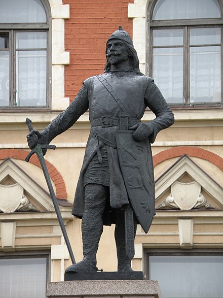
- Vyborg (Viborg), 60.712°, 28.742°. Vyborg Castle was set up by the Swedes in 1293 as a border outpost, and in 1403 Vyborg got city rights. It was the capital of Fief of Viborg (Sw. Viborgs slottslän, "lit. Vyborg castle province"), one of three such subdivisions of then-Finland and an important trading center. The city was besieged by Russians a couple of times, but until 1710 it remained Swedish. The city's medieval landmarks; the castle, the round tower, and the walls are all from the Swedish era. 2020-08-15
- Priozersk (Kexholm), 61.038°, 30.141°. Not far from Vyborg, at the shore of Lake Ladoga, this city too has a medieval fortress, Korela, but it's Russian built. Priozersk was Swedish for a few years during the Ingrian War, and again from 1611 to 1710. During that time, it was mostly a Swedish military city, and a Lutheran congregation was established there. 2020-08-15
- Novgorod, 58.525°, 31.262°. One of the historical cities of Russia, and one of the parties to the Treaty of Nöteborg. Occupied by the Swedes from 1611 to 1617 during the de la Gardie campaign. 2020-08-15
- Nienschantz monument, 59.94345°, 30.40529°. After the Ingrian War, in 1617, Sweden gained control over roughly today's Leningrad Oblast and southern half of Karelia. After that town by the name of Nyen (Swedish name for Neva) was set up here, at the confluence of the Neva and Okhta, together with Nyenskans (lit. "Nyen bastion"). Peter the Great conquered the fort in 1703, and started building present day Saint Petersburg around the location. Nowadays there is a nice commemorative marker, and no crowds at all.
- Oreshek fortress (Nöteborg), 59.9539°, 31.0385°. The first peace treaty between Sweden and Russia was signed here in 1323. The area including the fortress was under Swedish control during most of the 17th century. 2020-08-16
Ukraine and southeastern Europe
Sweden didn't hold any territory here, but this corner of Europe has some notable "Swedish" destinations; most of them related to the campaign by Charles XII in the Great Northern War.
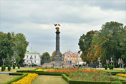
- Poltava, 49.587°, 34.548°. Sweden's most decisive defeat. Charles XII attempted to invade Russia during the Great Northern War, but like other armies who have attempted it, the winter of 1708-09 was harsh on the Caroleans. The Swedes managed to defeat a larger Russian force in Holowczyn east of Minsk in the summer of 1708, but a year later the Caroleans together with their Cossack Hetmanate allies were defeated on 8 July 1709 and it meant the end of the invasion. A few days later virtually the whole Swedish army surrendered in Perevolochna, south of Poltava.
- Bendery, 46.826°, 29.480°. Charles XII with some troops escaped from Poltava and make it to the friendly Ottoman Empire that had a history of animosity towards Russia. They were allowed to settle in Varnitsa next to Bendery, at the expense of the sultan. The Russians tried to come and get the Swedish king resulting in the Russo-Turkish war where the Russians were beaten. Nevertheless, in 1713 the Turks had had it supporting Charles (who came to be known as Demirbaş Şarl, "Charles the Fixture" due to his unexpectedly long stay), his few thousand men, and entertaining Charles' repeated attempts to persuade the sultan to go to war with Russia, so they decided to arrest the Swedes. The Swedes put up a fight, and the skirmish on 1 February 1713 was known as Kalabaliken i Bender. Kalabalık is Turkish for "gathering", but after the event the word was borrowed into Swedish, meaning "disorder" or "disturbance". 2020-08-15
- Didymoteicho, 41.3505°, 26.4938°. After his arrest in Bendery, Charles XII was brought to this town, at the present day border of Greece and Turkey. He spent a year and a half in house arrest here, and through letter correspondence he learned about the situation in Sweden and in Europe. In September 1714 he left for Pitești, and in October the king rode from there in just 14 days up to Stralsund in Swedish Pomerania. 2020-08-15
- Gammalsvenskby, 46.8708°, 33.5867°. The Estonian islands fell into Russian hands after the Great Northern War. At the beginning, the Swedish minority that stayed did retain their rights. Nevertheless, much of the Swedish population of Dagö (Ösel) was deported to Ukraine in August 1782. Out of the 1000 starting the foot march, only 135 would arrive next March in the place now known as Gammelsvenskby (Ukr. Старошведське), translating to "Old Swedish village". The community has went through hard times, especially during the Soviet Union and WWII, though there are still about 150 inhabitants in the village claiming Swedish heritage and some speaking the Old Swedish dialect.
Germany and Poland
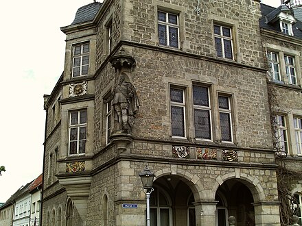
For a few years in the late 16th century, Poland and Sweden were ruled by the same monarch, the Catholic Sigismund III Vasa, and the breakup of this union lead to the long Swedish-Polish war.
Other than that, the Swedish didn't have real possessions in Poland but they did invade a few times. Coastal cities of the Polish-Lithuanian commonwealth like Elblag, Baltiysk and Klaipeda were occupied during the Swedish-Polish war and the overlapping Thirty Years War. After the latter, through the 1656 Treaty of Königsberg, the Duchy of Prussia became a Swedish fief.
-
Bremen-Verden, 53.598°, 9.462°. Despite the name, it didn't include the city of Bremen, but the area from the city border north to Elbe and the sea. It did go to war with the city on two occasions. The capital of the area was Stade. A former grain storage of the Swedish army now houses the Stade museum for cultural history. 2020-08-15

-
Stralsund, 54.301°, 13.090°. Stralsund has many Swedish buildings. The tower of St. Mary's church was destroyed by lighting in 1647, and was rebuilt to its current form during the Swedish era, finished in 1708. Catharine Monastery was used as an arsenal by the Swedes (it had already ceased to serve as a monastery earlier). The city hall went through a major renovation during the Swedish era, and one of its halls is named Löwen Hall after general-governor Axel von Löwen. The Commander's House was built to house the command of the Swedish garrison from 1751, and it still retains its blazon on the façade. Meyerfeldt Palace from 1730 was built for the governor-general Meyerfeldt as Stettin had been lost and Stralsund.
-
Greifswald, 54.093°, 13.385°. Capital of Swedish Pomerania 1720-1814. A notable building from the Schwedenzeit (Swedish time) is the University Main Building from 1750. 2020-08-15
-
Wismar, 53.894°, 11.468°. The Swedish tribunal was the main courthouse for the Swedish possessions south of the Baltic Sea and it was housed in Fürstenhof in Wismar for almost all of the Swedish time. A fortification system was set up around the city, which was largely destroyed during the Great Northern War but there are still a few remains visible. Central Wismar, together with Stralsund, is a world heritage site. 2020-08-15
-
Rügen, 54.416°, 13.409°. This island too formed part of Swedish Pomerania. Spyker Castle in Glowe, built in the 13th century, became the residence of the Swedish governor-general Wrangel in 1649, and later on it became the property of the Brahe family. After the Napoleonic Wars, the castle was sold to the Prussian prince. Nowadays the castle is a hotel. 2020-08-28
-
Lützen, 51.256°, 12.142°. The site of one of the most famous battles in the Thirty Year's War, where on 6 November 1632 the Swedes beat the Catholic forces but king Gustavus Adolphus died in battle.
-
Szczecin (Stettin), 53.426°, 14.551°. Capital of Swedish Pomerania 1630-1720.
North America
- New Sweden, Delaware, 39.808°, -75.444°. New Sweden was the largest Swedish territory outside Europe. It included both banks of the Delaware River, from the Atlantic up to present-day Philadelphia. The colony was established in 1638 by the Swedish South Company, when Fort Christina was set up in what is now Wilmington. The colony was invaded by the Dutch in 1655 and incorporated into New Netherlands, and while many residents stayed, large scale Swedish immigration to the US wouldn't begin until 200 years later. 2020-08-15
- American Swedish Historical Museum. A showcase of Swedish migration to America.
- Old Swedes' church (Holy Trinity Church), 39.7385°, -75.5405°. Although the area known as New Sweden became Dutch then English later, the Swedish and Finnish settlers chose to stay. In 1699 the Swedish community opened this church as the first Lutheran church in the New World. Still in use, though services are conducted in English, it's the oldest continuously used church in the United States. 2020-08-18
- Fort Christina State Park, 39.7373°, -75.5382°. A park where Fort Christina was established in 1638. During the era of English control it fell into disrepair, and in the War of 1812 Americans built Fort Union on the site. Nowadays just a memorial is left.
- Kalmar Nyckel, 39.7368°, -75.5367°. A 1998 replica of Kalmar Nyckel ("Key of Kalmar"), one of the two ships bringing the first settlers to New Sweden (the other was named Fågel Grip). Based in Wilmington, and makes cruises on the Delaware River.
- Gloria Dei Church (Old Swedes'), 8 Christian St (at Columbus Blvd., Philadelphia/South), 39.9344°, -75.1436°, +1 215 389-1513. Almost simultaneously with the Old Swedish church in Wilmington, Gloria Dei was constructed and opened in 1700 as a place of worship for the Swedish community in the area making up present-day Philadelphia. In 1845 Gloria Dei became an Episcopalian church. 2018-10-21

- St Barthelemy, 17.898°, -62.829°. First settled by the French, who traded the island to Sweden in 1784 for trading rights in Gothenburg. Some tropical plants were grown here, but it was most important as a free port. Therethrough Saint Barthelemy came to be a transit point for the Atlantic slave trade. The island's capital Gustavia, named for king Gustav III, was founded a few years into Swedish rule, and there are many buildings and sites in the city from the Swedish time. Some streets also have their old Swedish names signposted. France bought back the island in 1878.
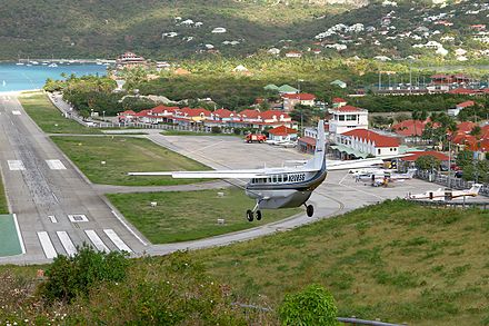
- Guadeloupe, 16.24°, -61.60°. Sweden's second, very short-lived, Caribbean colony. In the Napoleonic Wars, the British invaded the French island of Guadeloupe, and gave it to Sweden in 1813 for support against France and trading rights in Swedish ports. As the war ended in 1814, Sweden sold the island to France.
West Africa
-
Swedish Gold Coast, 5.106°, -1.244°. Sweden operated forts and trading posts also called "factories", in present-day Ghana from 1650 to 1663. These were Fort Carlsborg, Fort William, Fort Batenstein, Fort Christiansborg, Fort Witsen, Fort Apollonia, Gemoree Factory and Accara Factory. The forts changed hands among colonial powers in the region and some may be better known by other names. These were used to load enslaved Africans onto ships bound for the Americas as part of the Atlantic slave trade. 2020-08-15
-
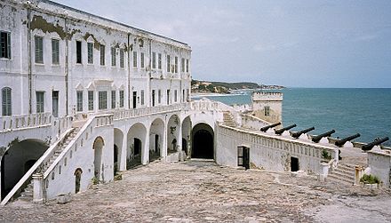
Fort Carlsborg/Carolusborg (Cape Coast Castle), 5.1035°, -1.2411°. The Swedish established a fort in 1653 to trade in tobacco, gold, slaves, sugar and timber, and it was later rebuilt in stone. Carolusborg was captured by the Danish in 1658, before in turn being annexed by the Dutch in 1663. The very next year, the English launched a successful invasion of the fort during the Second Anglo-Dutch War. Due to damage suffered by the fort due to man-made and environmental causes, the fort was rebuilt by the British in the 18th century, which is how the structure looks like for the most part in the 21st century. 2020-08-29
-
Fort William, 5.1741°, -1.1188°. Built by the Dutch in 1640 as a lodge, the Swedes held it from 1653 to 1657. 2020-08-29
-
Fort Batenstein, 4.8242°, -1.9171°. Built by the Dutch on the site of a Swedish trading post, to prevent the Swedes from landing there again. 2020-08-29
-
Osu Castle (Christiansborg Castle), 2 Barnes Road, Adabraka (Accra), 5.546930°, -0.183332°. The predecessor of the fort was a Swedish trading post and lodge, built in 1652. In 1660 the Dutch captured the are briefly before the Danish arrived. They built the castle on the site of the Swedish lodge. Before it was claimed by Denmark, it was used for trading precious metals, but once the Danes took power, it became a place to store slaves prior to shipping them. Later it became the headquarters of the Danish Gold Coast. Since that time, it has been used as a government building and when Ghana gained independence in 1957, it became the Presidential House. It remains the seat of government today, although there is controversy because of its ties to the slave trade. It is not open to walk-in visitors.
-
Fort Witsen, 4.9167°, -1.7496°. Built by the Dutch in 1665, on a Swedish trading post functioning from 1653 to 1658.
-
Fort Apollonia, 5.00002°, -2.64499°. Sweden operated a trading post here from 1655 to 1657. Later a British trading point was here, and in 1770 it was expanded into the present-day fort.
Timeline
<div style="font-size:smaller;">- 1520 Stockholm bloodbath: Christian II has Swedish noblemen executed in Stockholm
- 1521-23 Swedish Liberation War
- 1523 Gustav Vasa becomes King of Sweden; Kalmar Union is dissolved
- 1554-57 Russo-Swedish War ("Great Russian War"), leading to Treaty of Novgorod (status quo ante bellum)
- 1558-83 Livonian War
- 1560 Eric XIV king
- 1563-70 Northern Seven Year's War, leading to Treaty of Stettin (status quo ante bellum)
- 1568 John III king
- 1590-95 Russo-Swedish War, together with the Livonian War known as the "25 years war against Russia", leading to Treaty of Teusina. Northern Estonia becomes part of Sweden.
- 1592 Sigismund king
- 1598-99 War against Sigismund
- 1599 Duke Charles regent
- 1600-29 Polish War leading to the Truce of Altmark 1629, and Treaty of Stuhmsdorf 1635. Sweden receives the rest of present-day Estonia and northern part of present-day Latvia including Riga.
- 1604 Charles IX king
- 1609-10 De la Gardie Campaign
- 1610-17 Ingrian War, leading to Treaty of Stolbovo. Sweden receives Ingria and Kexholm county, amounting roughly to present day Leningrad Oblast.
- 1611 Gustavus Adolphus king
- 1618-48 Thirty Years' War, leading to the Peace of Westfalia. Sweden receives its possessions in present-day Germany including Swedish Pomerania and Bremen-Verden. During the war Swedish troops march throughout central Europe and besiege cities in Southern Germany
- 1628 Warship Vasa, the flagship of the Swedish navy, sinks on its maiden voyage
- 1632 Gustavus Adolphus dies in battle, Christina queen
- 1638 Fort Christina is built and New Sweden in present-day United States is established, Sweden's first colony outside Europe
- 1643-45 Torstenson War, leading to the Second Treaty of Brömsebo. Sweden receives Jämtland, Härjedalen, Gotland, Saaremaa, and in addition Halland for 30 years
- 1649 Sweden Africa Company is established and a trading post is set up in present-day Ghana
- 1654 Charles X Gustav king
- 1655 New Sweden is conquered by the Dutch Empire
- 1655-61 Second Northern War, leading to many treaties; the Treaty of Roskilde in 1658, and the Treaty of Copenhagen in 1660 both with Denmark, the Treaty Oliva with Poland in 1660 the Treaty of Kardis with Russia in 1661. Sweden receives Scania, Blekinge, Bohuslän, and Halland permanently. Moreover Sweden received Trøndelag and Bornholm in 1658, but they were returned to Denmark in 1660.
- 1660 Charles XI king
- 1663 The Dutch capture Fort Carolusborg, ending the Swedish presence in Africa
- 1674-79 Scanian War
- 1680s the reductions of Charles XI, meaning the power and privileges of nobility was reduced
- 1697 Charles XII king. The former royal castle Tre Kronor burns down, and the current Royal Palace is later built at the same spot.
- 1700-21 Great Northern War (the last years were known as the Greater Wrath in Finland) leading to the treaty of Nystad. Sweden loses its present-day Baltic and Russian possessions, Bremen-Verden and some of Pomerania.
- 1718 Charles XII dies in battle, Ulrica Eleanor queen
- 1720 Frederick I king
- 1733 Swedish East India Company establishes a trading post in India for just a month before it was attacked and destroyed by a British and French force
- 1741-43 Hat's Russian War (Minor Wrath) leading to the treaty of Åbo (Turku). Sweden loses more territory of present-day Finland and Kymi river now becomes the border with Russia.
- 1751 Adolf Frederick is crowned king
- 1757-62 Pomeranian War
- 1771 Gustav III king
- 1772 Gustav III launches a coup d'etat, establishing himself as an absolute monarch
- 1784 Sweden purchases St. Barthelemy
- 1788-90 Gustav III's Russian War leading to the treaty of Värälä (status quo ante bellum).
- 1792 Gustav III assassinated, Duke Charles regent, would later become king
- 1796 Gustav IV Adolph king
- 1805-14 Sweden becomes involved in the Napoleonic Wars, notably the 1808-09 Finnish War when Russia conquered the rest of Finland. But as a result of the war Norway became part of Sweden for almost a century.
- 1809 Gustav IV Adolph dethroned by military officers, Charles XIII king
- 1813 Britain transfers Guadeloupe, which it has occupied since an invasion in 1810, to Sweden, which returns it to its former owner, France, in 1814
- 1818 Charles XIV John king
- 1844 Oscar I king
- 1859 Charles XV king
- 1872 Oscar II king
- 1878 St. Barthelemy is transferred back to France for a sum of money
- 1905 Norway becomes independent; Sweden gets the borders and flag it has today.
See also
- King's Road (Finland) – during Swedish times the main road along the Finnish south coast
- Polish–Lithuanian Commonwealth - another regional power southwest of Sweden in existence from from 1569 to 1795, ie. during the same time as the Swedish Empire.
- Thirty Years' War – the war whose outcome established Sweden as a regional power
- Jewish Stockholm
Other colonial empires
- Austro-Hungarian Empire
- British Empire
- Danish Empire
- Dutch Empire
- French Colonial Empire
- German Empire
- Italian Empire
- Japanese colonial empire
- Portuguese Empire
- Russian Empire – together with Denmark, Sweden's main enemy around the Baltic
- Spanish Empire


